|
search place name
|
||
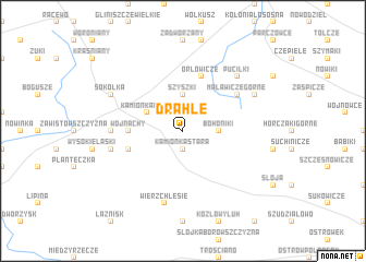
Drahle (Poland)Drahle is a town in Poland. An overview map of the region around Drahle is displayed below.
regional and 3d topo map of Drahle, Poland ::
Nearby towns ::
Kamionka Stara (1.9km south) //
Bobrowniki (2.2km east) //
Bohoniki (2.2km east) //
Szyszki (3.7km north) //
Kamionka Nowa (2.9km north west) //
Wojnachy (3.3km west) //
Bilwiny (3.8km south west) //
Pawełki (3.8km south west) //
Orłowicze (5.7km north) //
Malawicze Górne (5.0km north east) //
Kurowszczyzna (4.4km west) //
Wierzchlesie (7.5km south) //
Słojniki (4.8km south west) //
Puciłki (6.5km north east) //
Malawicze (5.8km north east) //
Malawicze Dolne (5.8km north east) //
Sokółka (5.8km north west) //
[all distances 'as the bird flies' and approximate]  Places with similar names to Drahle, Poland ::
Disclaimer :: Information on this page comes without warranty of any kind |
||
|
Where is Drahle? Elevation and coordinates ::
Latitude (lat): 53°23'0"N Longitude (lon): 23°34'0"E
Elevation (approx.): 172m (map arrows pan, magnifying glasses zoom) |
||
|
Visiting Drahle? Hotel/Accommodation ::
Book a hotel in Drahle Travel Guide ::
Buy a travel guide for Poland rental cars ::
car rental offers GPS waypoint ::
download a GPX waypoint (PoI) of Drahle for your GPS receiver
|
||