|
search place name
|
||
Gajówka (Poland)Gajówka is a town in Poland. An overview map of the region around Gajówka is displayed below.
regional and 3d topo map of Gajówka, Poland ::

Gajówka airports ::
The nearest airport is WAW - Warsaw Okecie, located 127.5 km east of Gajówka.
Other airports nearby include KTW - Katowice Pyrzowice (156.9 km south), KRK - Krakow Balice (205.5 km south), Nearby towns ::
Prawęcice (1.9km south) //
Krasnodęby Nowe (1.1km east) //
Bardzynska Huta (1.9km north) //
Karolinów (2.2km north east) //
Krasnodęby (2.3km east) //
Gołaszyny (3.7km north) //
Skorka (3.7km north) //
Chrośno (2.9km south east) //
Sobień (2.9km south east) //
Sarnów (3.9km south) //
Florentynów (2.9km north east) //
Anastazew (2.9km north east) //
Ignacew Dolny (3.9km north) //
Dąbrówka (2.9km north west) //
Jastrzębiec (4.4km south east) //
Dzierżanów (4.4km south west) //
Dalików (3.4km west) //
Kuciny (3.9km south west) //
Bełdów (6.0km south) //
Ciężków (6.0km south) //
Ignacew Parzęczewski (6.0km north) //
Józefów (6.0km south) //
Budzynek (6.0km north) //
Nowo Młyny (4.6km east) //
Reksuł (4.6km east) //
Krasnodęby Stare (4.6km east) //
Chrząstów (7.4km north) //
Malanów (7.5km south) //
Mariampol (4.9km east) //
[all distances 'as the bird flies' and approximate] 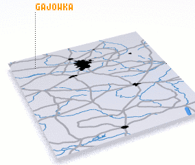 Places with similar names to Gajówka, Poland ::
Disclaimer :: Information on this page comes without warranty of any kind |
||
|
Where is Gajówka? Elevation and coordinates ::
Latitude (lat): 51°53'0"N Longitude (lon): 19°10'0"E
Elevation (approx.): 146m (map arrows pan, magnifying glasses zoom) |
||
|
Visiting Gajówka? Hotel/Accommodation ::
Book a hotel in Gajówka Travel Guide ::
Buy a travel guide for Poland rental cars ::
car rental offers GPS waypoint ::
download a GPX waypoint (PoI) of Gajówka for your GPS receiver
|
||