|
search place name
|
||
Głogowice (Poland)Głogowice is a town in Poland. An overview map of the region around Głogowice is displayed below.
regional and 3d topo map of Głogowice, Poland ::

Głogowice airports ::
The nearest airport is WAW - Warsaw Okecie, located 97.7 km north east of Głogowice.
Other airports nearby include KTW - Katowice Pyrzowice (156.4 km south), KRK - Krakow Balice (195.5 km south), Nearby towns ::
Teolin (1.9km south) //
Byszewy (1.1km west) //
Ignaców (1.1km east) //
Skoszwey Nowe (1.9km north) //
Plichtów (2.2km south west) //
Moskiew (2.2km south east) //
Lipiny (2.2km south east) //
Głąbie (2.2km north west) //
Boginia (2.3km west) //
Jaroszki (2.3km east) //
Natolin (3.9km south) //
Buczek (2.9km north east) //
Janinów (2.9km north east) //
Skoszewy Stare (3.9km north) //
Bertolin (3.9km north) //
Sierznia (3.9km north) //
Anielin-Kazimierzów (3.9km north) //
Ksawerów (4.4km south east) //
Ługi (4.4km north west) //
Grabina (3.4km west) //
Janów (3.9km south west) //
Polik (3.9km south east) //
Warszewice (5.7km north) //
Dobieszków (3.9km north west) //
Niesułków (5.7km north) //
Wiączyn Dolny (6.0km south) //
Pieńki (6.0km north) //
Nowosolna (5.1km south west) //
Lipka (6.0km north) //
[all distances 'as the bird flies' and approximate] 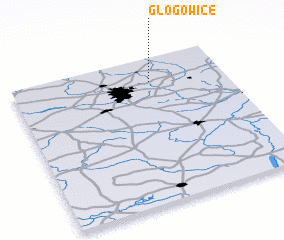 Places with similar names to Głogowice, Poland ::
// Galgweis (DE)
// Gałkowice (PL)
// Gołkowice (PL)
// Gołkowice (PL)
// Gołkowice (PL)
// Kiełkowice (PL)
// Kłokowice (PL)
// Kułakowice (PL)
Disclaimer :: Information on this page comes without warranty of any kind |
||
|
Where is Głogowice? Elevation and coordinates ::
Latitude (lat): 51°50'0"N Longitude (lon): 19°39'0"E
Elevation (approx.): 219m (map arrows pan, magnifying glasses zoom) |
||
|
Visiting Głogowice? Hotel/Accommodation ::
Book a hotel in Głogowice Travel Guide ::
Buy a travel guide for Poland rental cars ::
car rental offers GPS waypoint ::
download a GPX waypoint (PoI) of Głogowice for your GPS receiver
|
||