|
search place name
|
||
Grochołowie (Poland)Grochołowie is a town in Poland. An overview map of the region around Grochołowie is displayed below.
regional and 3d topo map of Grochołowie, Poland ::

Grochołowie airports ::
The nearest airport is TAT - Poprad Tatry, located 31.0 km south of Grochołowie.
Other airports nearby include KRK - Krakow Balice (85.9 km north), KSC - Kosice (108.7 km south east), SLD - Sliac (110.3 km south west), KTW - Katowice Pyrzowice (148.0 km north west), Nearby towns ::
Wojtyczki (0.0km north) //
Pawliki (2.2km north west) //
Łapszanka (2.2km north east) //
Rzepisko (2.4km west) //
Jurgów (3.0km south west) //
Łapsze Wyżne (5.7km north) //
Osturňa (4.1km south east) //
Czarna Góra (4.1km north west) //
Brzegi (4.1km south west) //
Bukowina Tatrzańska (4.8km west) //
Podspady (7.4km south) //
Dursztyn (7.5km north) //
Białka (6.1km north west) //
Trybsz (7.8km north) //
Łapsze Niżne (7.4km north east) //
[all distances 'as the bird flies' and approximate] 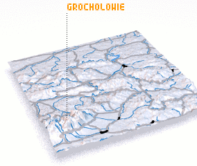 Places with similar names to Grochołowie, Poland :: Disclaimer :: Information on this page comes without warranty of any kind |
||
|
Where is Grochołowie? Elevation and coordinates ::
Latitude (lat): 49°21'0"N Longitude (lon): 20°11'0"E
Elevation (approx.): 941m (map arrows pan, magnifying glasses zoom) |
||
|
Visiting Grochołowie? Hotel/Accommodation ::
Book a hotel in Grochołowie Travel Guide ::
Buy a travel guide for Poland rental cars ::
car rental offers GPS waypoint ::
download a GPX waypoint (PoI) of Grochołowie for your GPS receiver
|
||