|
search place name
|
||
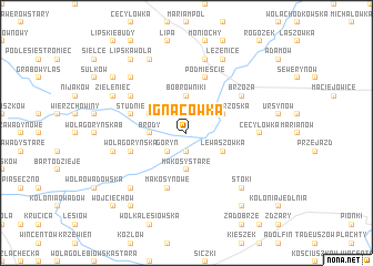
Ignacówka (Poland)Ignacówka is a town in Poland. An overview map of the region around Ignacówka is displayed below.
regional and 3d topo map of Ignacówka, Poland ::
Ignacówka airports ::
The nearest airport is WAW - Warsaw Okecie, located 70.5 km north of Ignacówka.
Other airports nearby include RZE - Rzeszow Jasionka (169.8 km south), KRK - Krakow Balice (197.1 km south west), Nearby towns ::
Kolonia Goryń (1.9km south) //
Stawki (2.2km north east) //
Łukawska Wola (2.2km north west) //
Goryń (2.2km south west) //
Brody (2.3km west) //
Bobrowniki (3.7km north) //
Mąkosy Stare (3.7km south) //
Mąkosy (3.7km south) //
Wólka Brzóska (3.0km north east) //
Łukawa (3.0km north west) //
Lewaszówka (3.0km south east) //
Studnie (3.9km north west) //
Jastrzębska Dąbrowa (5.7km south) //
Mąkosy Nowe (5.7km south) //
Wola Goryńska (3.9km south west) //
Osowie (3.9km south west) //
Podmieście (5.7km north) //
Brzóza (5.1km north east) //
Józefów (5.1km north west) //
Cecylówka (4.6km east) //
Głowaczów (7.5km north) //
Olszowa (5.0km west) //
Stoki (6.5km south east) //
Jastrzębskie Komorniki (6.5km south west) //
Miejska Dąbrowa (6.5km north west) //
Leżenice (7.8km north) //
Klementynów (7.8km north) //
Zieleniec (5.9km north west) //
Lipska Wola (8.2km north west) //
[all distances 'as the bird flies' and approximate] 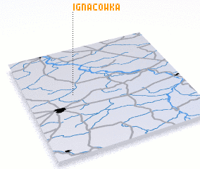 Places with similar names to Ignacówka, Poland ::
Disclaimer :: Information on this page comes without warranty of any kind |
||
|
Where is Ignacówka? Elevation and coordinates ::
Latitude (lat): 51°34'0"N Longitude (lon): 21°18'0"E
Elevation (approx.): 135m (map arrows pan, magnifying glasses zoom) |
||
|
Visiting Ignacówka? Hotel/Accommodation ::
Book a hotel in Ignacówka Travel Guide ::
Buy a travel guide for Poland rental cars ::
car rental offers GPS waypoint ::
download a GPX waypoint (PoI) of Ignacówka for your GPS receiver
|
||