|
search place name
|
||
Kępa (Poland)Kępa is a town in Poland. An overview map of the region around Kępa is displayed below.
regional and 3d topo map of Kępa, Poland ::

Kępa airports ::
The nearest airport is POZ - Poznan Lawica, located 102.7 km west of Kępa.
Other airports nearby include WRO - Wroclaw Strachowice (183.2 km south west), GDN - Gdansk Lecha Walesy (211.0 km north), OSP - Slupsk Redzikowo (236.5 km north), Nearby towns ::
Skulsk (0.0km north) //
Lisewo (1.9km south) //
Skulska Wieś (1.1km west) //
Piaski (1.1km east) //
Czartowo (2.2km south west) //
Pilich (2.2km north west) //
Zygmuntowo (2.2km south east) //
Mniszki (2.2km north east) //
Mielnica Duża (2.3km east) //
Mielnica Mała (2.9km south east) //
Krzywekolano (3.9km north) //
Mniszki B (3.9km north) //
Mniszki A (3.9km north) //
Warzymowo (4.3km south east) //
Łuszczewo (4.3km north east) //
Rakowo (3.4km west) //
Buszkowo (3.4km west) //
Kijowiec (5.7km south) //
Gawrony (5.7km south) //
Kalina (5.0km south east) //
Popielewo (5.0km south west) //
Koszewo (6.0km south) //
Kijowskie Nowiny (7.4km south) //
Przewóz (4.5km east) //
Żółwieniec (7.5km south) //
Broniszewo (4.9km east) //
Rzeszyn (7.5km north) //
Połajewo Nowe (4.9km east) //
Mielniki (6.5km south east) //
[all distances 'as the bird flies' and approximate] 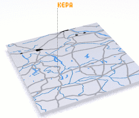 Places with similar names to Kępa, Poland ::
Disclaimer :: Information on this page comes without warranty of any kind |
||
|
Where is Kępa? Elevation and coordinates ::
Latitude (lat): 52°29'0"N Longitude (lon): 18°20'0"E
Elevation (approx.): 92m (map arrows pan, magnifying glasses zoom) |
||
|
Visiting Kępa? Hotel/Accommodation ::
Book a hotel in Kępa Travel Guide ::
Buy a travel guide for Poland rental cars ::
car rental offers GPS waypoint ::
download a GPX waypoint (PoI) of Kępa for your GPS receiver
|
||