|
search place name
|
||
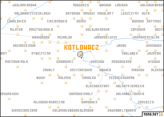
Kotłowacz (Poland)Kotłowacz is a town in Poland. An overview map of the region around Kotłowacz is displayed below.
regional and 3d topo map of Kotłowacz, Poland ::
Kotłowacz airports ::
The nearest airport is RZE - Rzeszow Jasionka, located 119.4 km south of Kotłowacz.
Other airports nearby include WAW - Warsaw Okecie (121.1 km north), KRK - Krakow Balice (164.2 km south west), Nearby towns ::
Rzeczniów (1.9km north) //
Wincentów (1.2km west) //
Rzeczniówek (2.2km north west) //
Kolonia Rzeczniów (2.2km north east) //
Krzyżanówka (3.7km south) //
Grabowiec (3.0km south west) //
Kochanówka (3.9km south) //
Grechów (3.0km south east) //
Michałów (4.4km north west) //
Stara Wieś (4.4km south east) //
Sienno (4.4km south east) //
Tarnówek (4.4km south east) //
Pawliczka (5.6km north) //
Aleksandrów (3.5km west) //
Rzechów (4.0km north west) //
Jelanka (4.0km north east) //
Karolew (5.7km south) //
Kolonia Rzechów (5.1km north west) //
Jawor Solecki (5.1km north east) //
Polesie (6.0km south west) //
Wola Jaworska (6.0km north east) //
Wodąca (5.1km south east) //
Wólka Modrzejowa (5.1km south west) //
Osinki (7.4km north) //
Dąbrowa (4.7km west) //
Marianów (7.5km north) //
Jawor Solecki Wyględów (6.6km north east) //
Płusy (5.9km north west) //
Janiszów (5.9km north west) //
[all distances 'as the bird flies' and approximate]  Places with similar names to Kotłowacz, Poland :: Disclaimer :: Information on this page comes without warranty of any kind |
||
|
Where is Kotłowacz? Elevation and coordinates ::
Latitude (lat): 51°7'0"N Longitude (lon): 21°26'0"E
Elevation (approx.): 188m (map arrows pan, magnifying glasses zoom) |
||
|
Visiting Kotłowacz? Hotel/Accommodation ::
Book a hotel in Kotłowacz Travel Guide ::
Buy a travel guide for Poland rental cars ::
car rental offers GPS waypoint ::
download a GPX waypoint (PoI) of Kotłowacz for your GPS receiver
|
||