|
search place name
|
||
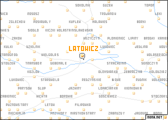
Latowicz (Poland)Latowicz is a town in Poland. An overview map of the region around Latowicz is displayed below.
regional and 3d topo map of Latowicz, Poland ::
Latowicz airports ::
The nearest airport is WAW - Warsaw Okecie, located 58.9 km west of Latowicz.
Other airports nearby include RZE - Rzeszow Jasionka (214.5 km south), Nearby towns ::
Dąbrówka (1.1km east) //
Waliska (3.7km north) //
Kamionka (2.9km north west) //
Kolonia Redzyńskie (3.9km south) //
Wężyczyn (3.9km north) //
Dębe Małe (3.9km south west) //
Stawek (5.7km north) //
Wola Stanisławowska (5.7km north) //
Łukowiec (3.9km north east) //
Redzyńskie (5.7km south) //
Budziska (5.7km south) //
Kołacz (6.0km north) //
Oleksianka (5.0km south east) //
Laliny (6.0km south) //
Jeruzal (5.0km north east) //
Wielgolas (4.6km west) //
Chromin (7.5km south) //
Chrominek (7.5km south) //
Jaźwiny (7.5km south) //
Strachomin (4.9km east) //
Chyżyny (4.9km west) //
Kuflew (7.5km north) //
Skupie (6.5km north west) //
Mała Wieś (7.8km north) //
Płomieniec (5.9km north east) //
Łopacianka (8.2km south east) //
Kiczki (7.2km north west) //
Piaseczno (8.2km north west) //
Starowola (7.2km south west) //
[all distances 'as the bird flies' and approximate]  Places with similar names to Latowicz, Poland ::
// Ludwigsaue (DE)
Disclaimer :: Information on this page comes without warranty of any kind |
||
|
Where is Latowicz? Elevation and coordinates ::
Latitude (lat): 52°2'0"N Longitude (lon): 21°48'0"E
Elevation (approx.): 134m (map arrows pan, magnifying glasses zoom) |
||
|
Visiting Latowicz? Hotel/Accommodation ::
Book a hotel in Latowicz Travel Guide ::
Buy a travel guide for Poland rental cars ::
car rental offers GPS waypoint ::
download a GPX waypoint (PoI) of Latowicz for your GPS receiver
|
||