|
search place name
|
||
Łazy (Poland)Łazy is a town in Poland. An overview map of the region around Łazy is displayed below.
regional and 3d topo map of Łazy, Poland ::

Łazy airports ::
The nearest airport is KRK - Krakow Balice, located 63.2 km west of Łazy.
Other airports nearby include RZE - Rzeszow Jasionka (97.0 km east), TAT - Poprad Tatry (112.9 km south), KTW - Katowice Pyrzowice (122.6 km north west), KSC - Kosice (159.8 km south), Nearby towns ::
Przyborów (1.9km south) //
Rudy Rysie (1.2km west) //
Szczepanów (3.7km south) //
Rudy (2.4km west) //
Łęki (3.9km south) //
Wokowice (4.4km south east) //
Borzęcin (4.4km north east) //
Mokrzyska (4.4km south west) //
Niedzieliska (4.4km north west) //
Rylowa (5.6km north) //
Zagrody (4.0km south west) //
Wygoda (4.0km north west) //
Zakręcie (5.7km north) //
Bielcza (5.1km east) //
Bucze (5.1km west) //
Szczurowa (7.5km north) //
Maszkienice (7.8km south) //
Jagniowka (7.8km north) //
Wola Dębińska (8.2km south east) //
Rajsko (7.3km north west) //
Rajsko Wielkie (7.3km north west) //
Kopaliny (8.8km south west) //
Rajsko Małe (8.8km north west) //
[all distances 'as the bird flies' and approximate] 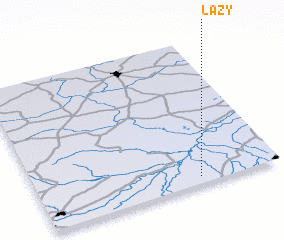 Places with similar names to Łazy, Poland ::
Disclaimer :: Information on this page comes without warranty of any kind |
||
|
Where is Łazy? Elevation and coordinates ::
Latitude (lat): 50°3'0"N Longitude (lon): 20°40'0"E
Elevation (approx.): 189m (map arrows pan, magnifying glasses zoom) |
||
|
Visiting Łazy? Hotel/Accommodation ::
Book a hotel in Łazy Travel Guide ::
Buy a travel guide for Poland rental cars ::
car rental offers GPS waypoint ::
download a GPX waypoint (PoI) of Łazy for your GPS receiver
|
||