|
search place name
|
||
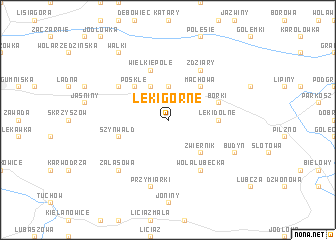
Łęki Górne (Poland)Łęki Górne is a town in Poland. An overview map of the region around Łęki Górne is displayed below.
regional and 3d topo map of Łęki Górne, Poland ::
Łęki Górne airports ::
The nearest airport is RZE - Rzeszow Jasionka, located 61.5 km east of Łęki Górne.
Other airports nearby include KRK - Krakow Balice (100.7 km west), TAT - Poprad Tatry (122.0 km south west), KSC - Kosice (146.9 km south), Nearby towns ::
Żurawieniec (3.7km north) //
Pogórska Wola (3.9km north) //
Zwiernik (4.4km south east) //
Pośkle (4.4km north west) //
Machowa (4.4km north east) //
Łęki Dolne (3.6km east) //
Szynwałd (4.0km south west) //
Wielkie Pole (5.7km north) //
Borki (4.0km north east) //
Wola Lubecka (6.0km south east) //
Pogórz (5.1km north west) //
Zdziary (6.0km north east) //
Przymiarki (7.5km south) //
Zalasowa (6.6km south west) //
Budyń (6.0km south east) //
Wałki (8.2km north west) //
[all distances 'as the bird flies' and approximate] 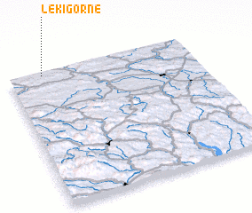 Places with similar names to Łęki Górne, Poland ::
Disclaimer :: Information on this page comes without warranty of any kind |
||
|
Where is Łęki Górne? Elevation and coordinates ::
Latitude (lat): 49°59'0"N Longitude (lon): 21°11'0"E
Elevation (approx.): 261m (map arrows pan, magnifying glasses zoom) |
||
|
Visiting Łęki Górne? Hotel/Accommodation ::
Book a hotel in Łęki Górne Travel Guide ::
Buy a travel guide for Poland rental cars ::
car rental offers GPS waypoint ::
download a GPX waypoint (PoI) of Łęki Górne for your GPS receiver
|
||