|
search place name
|
||
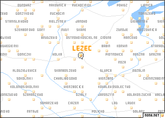
Łężec (Poland)Łężec is a town in Poland. An overview map of the region around Łężec is displayed below.
regional and 3d topo map of Łężec, Poland ::
Łężec airports ::
The nearest airport is POZ - Poznan Lawica, located 69.6 km west of Łężec.
Other airports nearby include WRO - Wroclaw Strachowice (150.1 km south west), KTW - Katowice Pyrzowice (222.6 km south east), Nearby towns ::
Kornaty (1.9km north) //
Strzałkowo (1.1km west) //
Bielawy (1.9km south) //
Ostrowo Kosćielne (3.7km north) //
Katarzynowo (3.9km north) //
Babin Holendry (2.9km north east) //
Skarboszewo (4.3km south west) //
Wólka (3.4km west) //
Skąpe (5.6km north) //
Babin (3.9km north east) //
Chwalibogowo (6.0km south) //
Kokczyn (5.0km north west) //
Ciosna (5.0km north east) //
Rudy (6.0km north) //
Gołków (6.0km south) //
Słupca (5.0km south east) //
Janowo (7.4km north) //
Kąty (7.4km south) //
Piotrowice (4.5km east) //
Wierzbocice (7.5km south) //
Wierzbno (6.5km south east) //
Brudzewo (5.9km north west) //
Grobla (5.9km south east) //
Mielżynek (8.2km north west) //
Mielżyn (8.7km north west) //
Kowalewo Sołectwo (8.7km south east) //
[all distances 'as the bird flies' and approximate]  Places with similar names to Łężec, Poland ::
Disclaimer :: Information on this page comes without warranty of any kind |
||
|
Where is Łężec? Elevation and coordinates ::
Latitude (lat): 52°19'0"N Longitude (lon): 17°50'0"E
Elevation (approx.): 101m (map arrows pan, magnifying glasses zoom) |
||
|
Visiting Łężec? Hotel/Accommodation ::
Book a hotel in Łężec Travel Guide ::
Buy a travel guide for Poland rental cars ::
car rental offers GPS waypoint ::
download a GPX waypoint (PoI) of Łężec for your GPS receiver
|
||