|
search place name
|
||
Miszory (Poland)Miszory is a town in Poland. An overview map of the region around Miszory is displayed below.
regional and 3d topo map of Miszory, Poland ::

Miszory airports ::
The nearest airport is WAW - Warsaw Okecie, located 47.1 km south east of Miszory.
Other airports nearby include KTW - Katowice Pyrzowice (224.5 km south west), Nearby towns ::
Władysławów (2.2km south east) //
Famułki Brochowskie (2.2km south east) //
Famułki Królewskie (2.3km east) //
Wólka Smolana (3.9km south) //
Lasocin (3.9km south) //
Kromnów Polski (3.9km north) //
Kirsztajnów (5.6km south) //
Brochów (3.9km south west) //
Tułowice (3.9km north west) //
Plecewice (6.0km south) //
Śladów (6.0km north) //
Konary (5.0km south west) //
Gorzewnica (5.0km north east) //
Żelazowa Wola (7.4km south) //
Łasice (4.9km west) //
Karolinów (4.9km east) //
Zdziarka (7.5km north) //
Wilkowiec (6.5km north east) //
Chodaków (7.8km south) //
Zwierzyniec (7.8km south) //
Strzyżew (7.8km south) //
Czerwińsk Nad Wisłą (7.8km north) //
Wola Pasikońska (8.2km south east) //
Wola (8.2km north west) //
Żuków (8.7km south west) //
Łazy (8.7km south east) //
Majdany (8.7km north west) //
[all distances 'as the bird flies' and approximate] 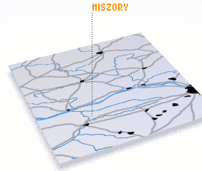 Places with similar names to Miszory, Poland ::
Disclaimer :: Information on this page comes without warranty of any kind |
||
|
Where is Miszory? Elevation and coordinates ::
Latitude (lat): 52°20'0"N Longitude (lon): 20°20'0"E
Elevation (approx.): 66m (map arrows pan, magnifying glasses zoom) |
||
|
Visiting Miszory? Hotel/Accommodation ::
Book a hotel in Miszory Travel Guide ::
Buy a travel guide for Poland rental cars ::
car rental offers GPS waypoint ::
download a GPX waypoint (PoI) of Miszory for your GPS receiver
|
||