|
search place name
|
||
Młynne (Poland)Młynne is a town in Poland. An overview map of the region around Młynne is displayed below.
regional and 3d topo map of Młynne, Poland ::

Młynne airports ::
The nearest airport is KRK - Krakow Balice, located 58.2 km north west of Młynne.
Other airports nearby include TAT - Poprad Tatry (76.3 km south), RZE - Rzeszow Jasionka (121.8 km east), KTW - Katowice Pyrzowice (125.0 km north west), KSC - Kosice (135.0 km south east), Nearby towns ::
Sowliny (1.9km south) //
Lipowe (2.2km south west) //
Makowica (2.2km north west) //
Łososina Górna (2.2km south west) //
Koszary (2.4km west) //
Laskowa (3.0km north east) //
Pasierbiec (3.0km north west) //
Laskowa Górna (4.4km north east) //
Żegocina (5.7km north) //
Limanowa (5.7km south) //
Rozdziele (6.1km north east) //
Mordarka (5.2km south east) //
Kisielówka (4.8km west) //
Stara Wieś (7.5km south) //
Bełdno (7.5km north) //
Zamieście (5.1km west) //
Kamionna (7.8km north) //
Słopnice Szlacheckie (7.3km south west) //
Słopnice (7.3km south west) //
Bytomsko (8.2km north east) //
Bytomsko Górne (8.2km north east) //
[all distances 'as the bird flies' and approximate] 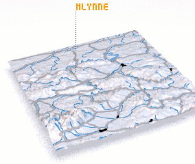 Places with similar names to Młynne, Poland ::
Disclaimer :: Information on this page comes without warranty of any kind |
||
|
Where is Młynne? Elevation and coordinates ::
Latitude (lat): 49°45'0"N Longitude (lon): 20°25'0"E
Elevation (approx.): 340m (map arrows pan, magnifying glasses zoom) |
||
|
Visiting Młynne? Hotel/Accommodation ::
Book a hotel in Młynne Travel Guide ::
Buy a travel guide for Poland rental cars ::
car rental offers GPS waypoint ::
download a GPX waypoint (PoI) of Młynne for your GPS receiver
|
||