|
search place name
|
||
Mzurowa (Poland)Mzurowa is a town in Poland. An overview map of the region around Mzurowa is displayed below.
regional and 3d topo map of Mzurowa, Poland ::

Mzurowa airports ::
The nearest airport is KRK - Krakow Balice, located 81.1 km south west of Mzurowa.
Other airports nearby include KTW - Katowice Pyrzowice (92.7 km west), RZE - Rzeszow Jasionka (137.5 km south east), WAW - Warsaw Okecie (167.1 km north), TAT - Poprad Tatry (182.9 km south), Nearby towns ::
Szczepanów (2.2km north east) //
Ossowa (2.3km east) //
Miąsowa (2.3km east) //
Bizorenda (3.9km north) //
Mnichów (3.0km south east) //
Podchoiny (5.6km south) //
Brzegi Małe (4.0km north east) //
Ignacówka (5.7km south) //
Lipnica (5.1km north west) //
Rembieszyce (6.0km north west) //
Wygoda (6.0km south east) //
Lasków (5.1km south west) //
Mniszek (4.7km west) //
Mniszek Dziadówki (5.0km west) //
Karsznice (7.5km north) //
Nowa Wieś (7.5km north) //
Wola Kawęcka (5.0km east) //
Wola Tesserowa (6.6km north west) //
Żerniki (6.0km north east) //
Podlaszcze (7.8km south) //
Brus (7.3km south east) //
Raków (8.2km south east) //
Chojny (7.3km north east) //
Gozna (8.8km south east) //
[all distances 'as the bird flies' and approximate] 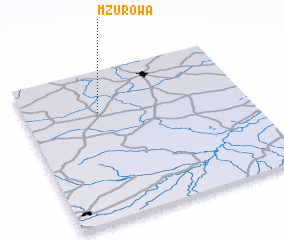
Disclaimer :: Information on this page comes without warranty of any kind |
||
|
Where is Mzurowa? Elevation and coordinates ::
Latitude (lat): 50°43'0"N Longitude (lon): 20°20'0"E
Elevation (approx.): 249m (map arrows pan, magnifying glasses zoom) |
||
|
Visiting Mzurowa? Hotel/Accommodation ::
Book a hotel in Mzurowa Travel Guide ::
Buy a travel guide for Poland rental cars ::
car rental offers GPS waypoint ::
download a GPX waypoint (PoI) of Mzurowa for your GPS receiver
|
||