|
search place name
|
||
Płocicz (Poland)Płocicz is a town in Poland. An overview map of the region around Płocicz is displayed below.
regional and 3d topo map of Płocicz, Poland ::

Płocicz airports ::
The nearest airport is OSP - Slupsk Redzikowo, located 112.2 km north of Płocicz.
Other airports nearby include GDN - Gdansk Lecha Walesy (115.9 km north east), POZ - Poznan Lawica (128.7 km south), IEG - Zielona Gora Babimost (190.7 km south west), Nearby towns ::
Kamień Krajeński (3.7km north) //
Kamień (3.7km north) //
Piaseczno (3.9km south) //
Dziechowo (3.9km south) //
Sikorz (4.3km south east) //
Sępólno Krajeńskie (5.7km south) //
Wiśniewka (5.7km south) //
Duża Cerkwica (5.0km north east) //
Mała Cerkwica (4.8km north east) //
Orzełek (7.5km north) //
Lutówko (4.8km south west) //
Wiśniewa (6.5km south west) //
Obkas (7.7km north) //
[all distances 'as the bird flies' and approximate] 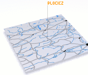 Places with similar names to Płocicz, Poland ::
// Palézieux (CH)
// Plūščikės (LT)
// Plačikus (BA)
// Palos Secos (MX)
// Palos Secos (AR)
// Pleskići (CS)
// Paillassieux (FR)
Disclaimer :: Information on this page comes without warranty of any kind |
||
|
Where is Płocicz? Elevation and coordinates ::
Latitude (lat): 53°30'0"N Longitude (lon): 17°31'0"E
Elevation (approx.): 136m (map arrows pan, magnifying glasses zoom) |
||
|
Visiting Płocicz? Hotel/Accommodation ::
Book a hotel in Płocicz Travel Guide ::
Buy a travel guide for Poland rental cars ::
car rental offers GPS waypoint ::
download a GPX waypoint (PoI) of Płocicz for your GPS receiver
|
||