|
search place name
|
||
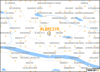
Płonczyn (Poland)Płonczyn is a town in Poland. An overview map of the region around Płonczyn is displayed below.
regional and 3d topo map of Płonczyn, Poland ::
Płonczyn airports ::
The nearest airport is WAW - Warsaw Okecie, located 127.0 km south east of Płonczyn.
Other airports nearby include GDN - Gdansk Lecha Walesy (195.0 km north), Nearby towns ::
Kochoń (1.1km east) //
Zakrzewo (1.9km north) //
Mokowo (2.2km east) //
Płomiany (3.7km south) //
Główczyn (2.2km west) //
Skaszewo (3.9km south) //
Tupadły (3.9km north) //
Kamienne Brody (2.9km north east) //
Bętlewo (2.9km north west) //
Lipiny (4.3km north west) //
Zbyszewo (4.3km south west) //
Mokówko (3.4km east) //
Dobrzyń nad Wisłą (5.7km south) //
Kolonia Borowo (3.8km north east) //
Rumunki Będzeń (6.0km north) //
Lenie Małe (5.0km south east) //
Teodorowo (6.0km north) //
Dobiegniewo (7.4km south) //
Chalin (4.9km east) //
Oleszno (4.9km west) //
Rumunki Orłowo (7.5km north) //
Miodusy (6.5km north west) //
Wielgie (6.5km north west) //
Lenie Wielkie (6.5km south east) //
Turza Wilcza Rumunki (5.8km north east) //
Kamienica (7.1km south east) //
Nowa Wieś (7.1km north west) //
Rumunki Jasieńskie (8.1km north east) //
[all distances 'as the bird flies' and approximate]  Places with similar names to Płonczyn, Poland ::
// Pillingsen (DE)
Disclaimer :: Information on this page comes without warranty of any kind |
||
|
Where is Płonczyn? Elevation and coordinates ::
Latitude (lat): 52°42'0"N Longitude (lon): 19°19'0"E
Elevation (approx.): 105m (map arrows pan, magnifying glasses zoom) |
||
|
Visiting Płonczyn? Hotel/Accommodation ::
Book a hotel in Płonczyn Travel Guide ::
Buy a travel guide for Poland rental cars ::
car rental offers GPS waypoint ::
download a GPX waypoint (PoI) of Płonczyn for your GPS receiver
|
||