|
search place name
|
||
Podlesie (Poland)Podlesie is a town in Poland. An overview map of the region around Podlesie is displayed below.
regional and 3d topo map of Podlesie, Poland ::

Podlesie airports ::
The nearest airport is KRK - Krakow Balice, located 47.7 km east of Podlesie.
Other airports nearby include KTW - Katowice Pyrzowice (58.5 km north), OSR - Ostrava Mosnov (79.9 km west), TAT - Poprad Tatry (125.5 km south east), PRV - Prerov (138.8 km south west), Nearby towns ::
Jawiszowice (0.0km north) //
Brzeszcze (3.7km north) //
Nazieleńce (3.9km north) //
Zielona (3.9km north) //
Łęskie Zasole (3.0km north east) //
Dankowice (3.0km south west) //
Przecieszyn (3.0km north east) //
Stara Wieś (3.9km south) //
Zasole Bielańskie (3.0km south east) //
Wilamowice (3.9km south) //
Kaniów Dankowski (3.6km west) //
Bór (5.6km north) //
Bielany (3.6km east) //
Góra (4.0km north west) //
Hecznarowice (5.7km south) //
Wilczkowice (5.2km north east) //
Skidzin (5.2km north east) //
Dębina (5.2km south west) //
Janowice (5.2km south west) //
Harmęże (7.4km north) //
Łęki (4.8km east) //
Pisarzowice (7.4km south) //
Wola (7.5km north) //
Gilowice (6.6km north west) //
Rajsko (7.8km north) //
Stare Stawy (8.8km north east) //
[all distances 'as the bird flies' and approximate] 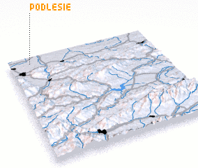 Places with similar names to Podlesie, Poland ::
Disclaimer :: Information on this page comes without warranty of any kind |
||
|
Where is Podlesie? Elevation and coordinates ::
Latitude (lat): 49°57'0"N Longitude (lon): 19°9'0"E
Elevation (approx.): 266m (map arrows pan, magnifying glasses zoom) |
||
|
Visiting Podlesie? Hotel/Accommodation ::
Book a hotel in Podlesie Travel Guide ::
Buy a travel guide for Poland rental cars ::
car rental offers GPS waypoint ::
download a GPX waypoint (PoI) of Podlesie for your GPS receiver
|
||