|
search place name
|
||
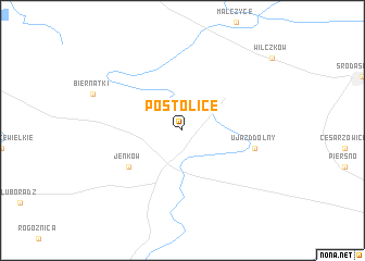
Postolice (Poland)Postolice is a town in Poland. An overview map of the region around Postolice is displayed below.
regional and 3d topo map of Postolice, Poland ::
Postolice airports ::
The nearest airport is WRO - Wroclaw Strachowice, located 31.7 km east of Postolice.
Other airports nearby include IEG - Zielona Gora Babimost (121.9 km north), PED - Pardubice (132.2 km south), BBJ - Bautzen (134.1 km west), POZ - Poznan Lawica (147.6 km north), Nearby towns ::
Jenków (5.1km south west) //
Ujazd Dolny (5.0km east) //
[all distances 'as the bird flies' and approximate] 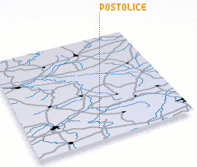 Places with similar names to Postolice, Poland ::
// Peustelsau (DE)
// Pozo Dulce (CU)
// Pištelići (BA)
// Posadillas (ES)
// Pastales (CO)
// Pozo de Luis (MX)
// Pozo Dulce (VE)
// Puesto Lucy (PY)
// Puesto Luis (PY)
// Počedělice (CZ)
Disclaimer :: Information on this page comes without warranty of any kind |
||
|
Where is Postolice? Elevation and coordinates ::
Latitude (lat): 51°7'0"N Longitude (lon): 16°26'0"E
Elevation (approx.): 151m (map arrows pan, magnifying glasses zoom) |
||
|
Visiting Postolice? Hotel/Accommodation ::
Book a hotel in Postolice Travel Guide ::
Buy a travel guide for Poland rental cars ::
car rental offers GPS waypoint ::
download a GPX waypoint (PoI) of Postolice for your GPS receiver
|
||