|
search place name
|
||
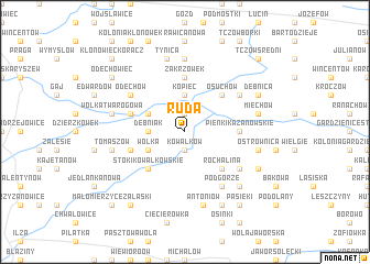
Ruda (Poland)Ruda is a town in Poland. An overview map of the region around Ruda is displayed below.
regional and 3d topo map of Ruda, Poland ::
Ruda airports ::
The nearest airport is WAW - Warsaw Okecie, located 104.4 km north of Ruda.
Other airports nearby include RZE - Rzeszow Jasionka (135.9 km south), KRK - Krakow Balice (174.7 km south west), Nearby towns ::
Niedarczów Dolny (1.9km north) //
Kowalków (1.9km south) //
Borów (1.9km south) //
Kopiec (3.7km north) //
Dębniak (2.3km west) //
Kolonia Niedarczów Górny (3.0km north west) //
Wólka (3.0km south west) //
Osuchów (4.4km north east) //
Stoki Kowalkowskie (4.4km south west) //
Rochalina (4.4km south east) //
Zakrzówek (5.6km north) //
Rawica Stara (5.6km north) //
Pieńki Kazanowskie (3.5km east) //
Ostrówka (3.5km east) //
Niedarczów Górny (3.9km north west) //
Ignaców (3.9km south west) //
Odechów (5.1km north west) //
Kolonia Osuchów (5.1km north east) //
Podgórze (6.0km south east) //
Kolonia Ostrownica (5.1km south east) //
Rawica (7.4km north) //
Tynica (7.5km north) //
Wólka Twarogowa (5.0km west) //
Miasteczko (5.0km west) //
Kazanów (5.0km east) //
Miechów (5.0km east) //
Antoniów (7.5km south) //
Tomaszów (5.0km west) //
Ostrownica (5.0km east) //
[all distances 'as the bird flies' and approximate]  Places with similar names to Ruda, Poland ::
Disclaimer :: Information on this page comes without warranty of any kind |
||
|
Where is Ruda? Elevation and coordinates ::
Latitude (lat): 51°16'0"N Longitude (lon): 21°24'0"E
Elevation (approx.): 154m (map arrows pan, magnifying glasses zoom) |
||
|
Visiting Ruda? Hotel/Accommodation ::
Book a hotel in Ruda Travel Guide ::
Buy a travel guide for Poland rental cars ::
car rental offers GPS waypoint ::
download a GPX waypoint (PoI) of Ruda for your GPS receiver
|
||