|
search place name
|
||
Rzeszotków (Poland)Rzeszotków is a town in Poland. An overview map of the region around Rzeszotków is displayed below.
regional and 3d topo map of Rzeszotków, Poland ::

Rzeszotków airports ::
The nearest airport is WAW - Warsaw Okecie, located 97.7 km west of Rzeszotków.
Nearby towns ::
Uziębły (0.0km north) //
Strusy (1.9km south) //
Czarnoty (2.2km north east) //
Nasiłów (2.9km north east) //
Krześlin (4.3km south west) //
Ostrówek (4.3km north east) //
Smuniew (5.6km north) //
Hołubla (3.4km east) //
Nakory (3.4km west) //
Kobylany Górne (5.7km north) //
Brzozów (3.9km south west) //
Czepielin (5.7km south) //
Kownaciska (5.0km south west) //
Stasin (5.0km south east) //
Wyrozęby Podawce (6.0km north) //
Patrykozy (5.0km north west) //
Kobylany Kozy (5.0km north east) //
Skwierczyn Lacki (5.0km north east) //
Krynki (4.5km east) //
Kolonia Golice (7.5km south) //
Włodki (7.5km north) //
Grabowiec (4.9km east) //
Skwierczyn (6.5km north east) //
Wyrozęby (6.5km north east) //
Kolonia Czepielin (6.5km south east) //
Kożuchówek (7.8km north) //
Kożuchów (8.2km north west) //
Wyrozęby Konaty (8.2km north east) //
Ogrodniki (7.2km south east) //
[all distances 'as the bird flies' and approximate] 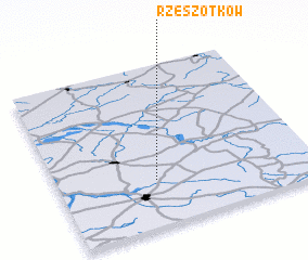
Disclaimer :: Information on this page comes without warranty of any kind |
||
|
Where is Rzeszotków? Elevation and coordinates ::
Latitude (lat): 52°17'0"N Longitude (lon): 22°23'0"E
Elevation (approx.): 148m (map arrows pan, magnifying glasses zoom) |
||
|
Visiting Rzeszotków? Hotel/Accommodation ::
Book a hotel in Rzeszotków Travel Guide ::
Buy a travel guide for Poland rental cars ::
car rental offers GPS waypoint ::
download a GPX waypoint (PoI) of Rzeszotków for your GPS receiver
|
||