|
search place name
|
||
Sławin (Poland)Sławin is a town in Poland. An overview map of the region around Sławin is displayed below.
regional and 3d topo map of Sławin, Poland ::

Sławin airports ::
The nearest airport is WAW - Warsaw Okecie, located 92.3 km north west of Sławin.
Other airports nearby include RZE - Rzeszow Jasionka (155.7 km south), KRK - Krakow Balice (211.1 km south west), Nearby towns ::
Zalesie (2.2km north east) //
Kociołek (2.2km south west) //
Sarnów (3.7km south) //
Wola Klasztorna (3.7km north) //
Zawada Nowa (2.3km west) //
Mieścisko (3.9km south) //
Sławczyn (3.0km north east) //
Nagórnik (4.4km north east) //
Gniewoszów (4.4km south east) //
Bierdzież (4.4km south west) //
Kępice (5.6km north) //
Opactwo (5.6km north) //
Oleksów (3.5km east) //
Posiołek (5.7km north) //
Sieciechów (5.7km north) //
Zawada Stara (3.9km south west) //
Występ (6.0km north east) //
Wólka Wojcieszkowska (5.1km north east) //
Granica (5.1km south east) //
Zdunków (5.1km south east) //
Piątków (6.0km south west) //
Bąkowiec (4.6km west) //
Zwola Stara (7.5km south) //
Wygoda (7.5km south) //
Łoje (7.5km north) //
Chechły (7.5km south) //
Marianów (6.6km south east) //
Zajezierze (6.5km north east) //
Borek (5.9km north east) //
[all distances 'as the bird flies' and approximate] 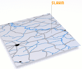 Places with similar names to Sławin, Poland ::
Disclaimer :: Information on this page comes without warranty of any kind |
||
|
Where is Sławin? Elevation and coordinates ::
Latitude (lat): 51°30'0"N Longitude (lon): 21°46'0"E
Elevation (approx.): 111m (map arrows pan, magnifying glasses zoom) |
||
|
Visiting Sławin? Hotel/Accommodation ::
Book a hotel in Sławin Travel Guide ::
Buy a travel guide for Poland rental cars ::
car rental offers GPS waypoint ::
download a GPX waypoint (PoI) of Sławin for your GPS receiver
|
||