|
search place name
|
||
Sobień (Poland)Sobień is a town in Poland. An overview map of the region around Sobień is displayed below.
regional and 3d topo map of Sobień, Poland ::

Sobień airports ::
The nearest airport is WAW - Warsaw Okecie, located 110.1 km north east of Sobień.
Other airports nearby include KTW - Katowice Pyrzowice (123.1 km south west), KRK - Krakow Balice (137.2 km south), RZE - Rzeszow Jasionka (176.9 km south east), Nearby towns ::
Radonek (1.9km south) //
Białaczów (3.7km north) //
Trzemoszna (3.7km south) //
Zakrzów (3.0km north east) //
Sworzyce (4.4km south west) //
Kopaniny (5.6km south) //
Ilińsko (5.7km north) //
Jeżów (3.9km south east) //
Bedlno (5.7km south) //
Parczów (6.0km north east) //
Miedzna Drewniana (6.0km north west) //
Pomorzany (6.0km south east) //
Grabków (6.0km south west) //
Sędów (4.6km east) //
Górki Niemojewskie (4.6km west) //
Przybyszowy (7.4km south) //
Sitowa (7.5km north) //
Ostrów (7.5km north) //
Waglany (7.5km north) //
Ossa (5.0km west) //
Bedlenko (7.5km south) //
Miedzna Murowana (5.9km north west) //
Gracuch (5.9km south east) //
Żelazowice (7.2km north west) //
Modliszewice (7.2km south east) //
Parczówek (8.7km north east) //
Sierosławice (8.7km south east) //
[all distances 'as the bird flies' and approximate] 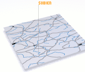 Places with similar names to Sobień, Poland ::
Disclaimer :: Information on this page comes without warranty of any kind |
||
|
Where is Sobień? Elevation and coordinates ::
Latitude (lat): 51°16'0"N Longitude (lon): 20°18'0"E
Elevation (approx.): 236m (map arrows pan, magnifying glasses zoom) |
||
|
Visiting Sobień? Hotel/Accommodation ::
Book a hotel in Sobień Travel Guide ::
Buy a travel guide for Poland rental cars ::
car rental offers GPS waypoint ::
download a GPX waypoint (PoI) of Sobień for your GPS receiver
|
||