|
search place name
|
||
Srocko (Poland)Srocko is a town in Poland. An overview map of the region around Srocko is displayed below.
regional and 3d topo map of Srocko, Poland ::

Srocko airports ::
The nearest airport is KTW - Katowice Pyrzowice, located 38.2 km south of Srocko.
Other airports nearby include KRK - Krakow Balice (88.9 km south east), OSR - Ostrava Mosnov (147.2 km south west), WAW - Warsaw Okecie (193.2 km north east), PRV - Prerov (201.9 km south west), Nearby towns ::
Kusięta (1.9km south) //
Siedlec Mirowski (1.9km north) //
Kolonia Mirów (2.3km west) //
Brzyszów (2.3km east) //
Jaskrów (3.7km north) //
Małusy Małe (3.5km east) //
Olsztyn (5.7km south) //
Mstów (5.1km north east) //
Cegielnia (5.1km north east) //
Kucelin (5.0km west) //
Mirów (5.0km west) //
Konin (7.5km north) //
Wancerzów (6.6km north east) //
Turów Górny (6.0km south east) //
Rędziny (7.8km north) //
Słowik (7.3km south west) //
Przymiłowice (7.3km south east) //
Kotysów-Przemiłowice (7.3km south east) //
Wyczerpy Dolne (7.3km north west) //
Wyczerpy Górne (7.3km north west) //
Kuchary (8.8km north east) //
[all distances 'as the bird flies' and approximate] 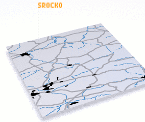 Places with similar names to Srocko, Poland ::
Disclaimer :: Information on this page comes without warranty of any kind |
||
|
Where is Srocko? Elevation and coordinates ::
Latitude (lat): 50°48'0"N Longitude (lon): 19°15'0"E
Elevation (approx.): 275m (map arrows pan, magnifying glasses zoom) |
||
|
Visiting Srocko? Hotel/Accommodation ::
Book a hotel in Srocko Travel Guide ::
Buy a travel guide for Poland rental cars ::
car rental offers GPS waypoint ::
download a GPX waypoint (PoI) of Srocko for your GPS receiver
|
||