|
search place name
|
||
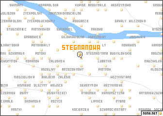
Stegna Nowa (Poland)Stegna Nowa is a town in Poland. An overview map of the region around Stegna Nowa is displayed below.
regional and 3d topo map of Stegna Nowa, Poland ::
Stegna Nowa airports ::
The nearest airport is WAW - Warsaw Okecie, located 66.4 km east of Stegna Nowa.
Other airports nearby include KTW - Katowice Pyrzowice (217.2 km south), Nearby towns ::
Stegna (0.0km north) //
Iłów (0.0km north) //
Brzozowiec (1.9km south) //
Gilówka Górna (2.2km north west) //
Miękiny (2.2km north east) //
Stegna Stara (2.3km east) //
Brzozów Nowy (3.9km south) //
Brzozów Stary (3.9km south) //
Gilówka Dolna (3.9km north) //
Pieczyska Iłowskie (3.9km north) //
Uderz (2.9km north east) //
Uderz Mały (2.9km north east) //
Pieczyska Łowickie (3.9km north) //
Karłowo (4.3km south west) //
Uderz Nowy (4.3km north east) //
Załusków (3.9km south west) //
Lubatka (3.9km south east) //
Grzybów (3.9km north west) //
Zalesie (6.0km south) //
Suchodół (6.0km north) //
Kaptury (5.0km south west) //
Piotrów (5.0km south east) //
Giżyce (5.0km south east) //
Rakowo (6.0km north) //
Brzeziny (4.5km west) //
Konstantynów (7.4km south) //
Jamno (4.5km west) //
Podgórze (7.4km north) //
Łaziska (4.5km east) //
[all distances 'as the bird flies' and approximate]  Places with similar names to Stegna Nowa, Poland :: Disclaimer :: Information on this page comes without warranty of any kind |
||
|
Where is Stegna Nowa? Elevation and coordinates ::
Latitude (lat): 52°20'0"N Longitude (lon): 20°2'0"E
Elevation (approx.): 74m (map arrows pan, magnifying glasses zoom) |
||
|
Visiting Stegna Nowa? Hotel/Accommodation ::
Book a hotel in Stegna Nowa Travel Guide ::
Buy a travel guide for Poland rental cars ::
car rental offers GPS waypoint ::
download a GPX waypoint (PoI) of Stegna Nowa for your GPS receiver
|
||