|
search place name
|
||
Szkudaj (Poland)Szkudaj is a town in Poland. An overview map of the region around Szkudaj is displayed below.
regional and 3d topo map of Szkudaj, Poland ::

Szkudaj airports ::
The nearest airport is WAW - Warsaw Okecie, located 129.8 km south of Szkudaj.
Other airports nearby include GDN - Gdansk Lecha Walesy (177.0 km north west), KGD - Kaliningrad Khrabrovo (179.2 km north), Nearby towns ::
Górowo (0.0km north) //
Bartki (1.1km west) //
Zbyluty (2.2km east) //
Ważyny (3.7km north) //
Kamionka (3.7km north) //
Powierz (2.9km south east) //
Kanigowo (3.9km north) //
Pawliki (3.9km north) //
Szymany (3.9km north) //
Zaborowo (2.9km north west) //
Krokowo (4.3km south west) //
Napierki (5.7km south) //
Pepłówek (5.7km south) //
Safronka (3.8km north east) //
Wiłunie (3.8km north east) //
Pielgrzymowo (6.0km north) //
Piątki (7.4km north) //
Miecznikowo Gołębie (4.8km south east) //
Białuty (7.5km south) //
Tatary (7.5km north) //
Zalesie (4.8km north west) //
Olszewko (7.5km north) //
Zagrzewo (6.5km north east) //
Pepłowo Wielkie (7.7km south) //
Zabłocie Kanigowskie (5.8km north east) //
Olszewo (7.7km north) //
Kulany (8.1km south east) //
Wola (7.1km south west) //
[all distances 'as the bird flies' and approximate] 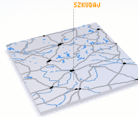
Disclaimer :: Information on this page comes without warranty of any kind |
||
|
Where is Szkudaj? Elevation and coordinates ::
Latitude (lat): 53°17'0"N Longitude (lon): 20°25'0"E
Elevation (approx.): 181m (map arrows pan, magnifying glasses zoom) |
||
|
Visiting Szkudaj? Hotel/Accommodation ::
Book a hotel in Szkudaj Travel Guide ::
Buy a travel guide for Poland rental cars ::
car rental offers GPS waypoint ::
download a GPX waypoint (PoI) of Szkudaj for your GPS receiver
|
||