|
search place name
|
||
Umer (Poland)Umer is a town in Poland. An overview map of the region around Umer is displayed below.
regional and 3d topo map of Umer, Poland ::

Umer airports ::
The nearest airport is KRK - Krakow Balice, located 115.0 km south west of Umer.
Other airports nearby include KTW - Katowice Pyrzowice (119.3 km south west), WAW - Warsaw Okecie (134.5 km north), RZE - Rzeszow Jasionka (141.5 km south east), TAT - Poprad Tatry (213.7 km south), Nearby towns ::
Ćmińsk Światełek (0.0km north) //
Ćmińsk Wyręba (1.2km west) //
Tumlin (2.2km south east) //
Tumlin Dąbrówka (2.2km south east) //
Ćmińsk (2.2km south west) //
Ćmińsk Podgrodzie (2.2km south west) //
Miedziana Góra (3.7km south) //
Tumlin Podgrodzie (3.7km south) //
Kołomań (2.3km east) //
Bobrza-Baraki (2.3km west) //
Tumlin Wykień (3.9km south) //
Ćmińsk Wykień (3.9km south) //
Ćmińsk Kościelny (3.0km south west) //
Ćmińsk Wyrowce (4.4km south west) //
Kołomań (4.4km north east) //
Kostomłoty Drugie (5.6km south) //
Przyjmo (3.5km west) //
Ćmińsk Kobylaki (3.5km west) //
Berlinka (3.5km west) //
Samsonów (3.5km east) //
Bobrza (4.0km south west) //
Janaszów (4.0km north east) //
Ślefarnia (5.1km south west) //
Porzecze (5.1km south west) //
Laskowa (6.0km south west) //
Ciosowa (6.0km south west) //
Pępice (4.7km west) //
Niewachlów (7.5km south) //
Kostomłoty Pierwsze (7.5km south) //
[all distances 'as the bird flies' and approximate] 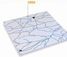 Places with similar names to Umer, Poland ::
Disclaimer :: Information on this page comes without warranty of any kind |
||
|
Where is Umer? Elevation and coordinates ::
Latitude (lat): 50°59'0"N Longitude (lon): 20°34'0"E
Elevation (approx.): 294m (map arrows pan, magnifying glasses zoom) |
||
|
Visiting Umer? Hotel/Accommodation ::
Book a hotel in Umer Travel Guide ::
Buy a travel guide for Poland rental cars ::
car rental offers GPS waypoint ::
download a GPX waypoint (PoI) of Umer for your GPS receiver
|
||