|
search place name
|
||
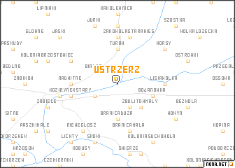
Ustrzerz (Poland)Ustrzerz is a town in Poland. An overview map of the region around Ustrzerz is displayed below.
regional and 3d topo map of Ustrzerz, Poland ::
Ustrzerz airports ::
The nearest airport is WAW - Warsaw Okecie, located 125.8 km west of Ustrzerz.
Other airports nearby include RZE - Rzeszow Jasionka (194.0 km south), LWO - Lvov Lviv Intl (238.2 km south), Nearby towns ::
Siedlanów (1.9km north) //
Zbulitów Duży (3.9km south) //
Zbulitów (3.9km south) //
Kozirynek Nowy (2.9km south west) //
Białka (2.9km north west) //
Zbulitów Mały (4.4km south east) //
Branica Duża (5.6km south) //
Turów (5.6km north) //
Bojanówka (3.9km south east) //
Lisia Wólka (4.6km east) //
Nadwitne (4.6km west) //
Żakowola (7.4km north) //
Żakowola Radzyński (7.4km north) //
Kozirynek Stary (4.9km west) //
Branica Mała (7.5km south) //
Żakowola Stara Wieś (7.5km north) //
Płudy (5.9km north west) //
Niewęgłosz (8.2km south west) //
Worsy (7.2km north east) //
[all distances 'as the bird flies' and approximate] 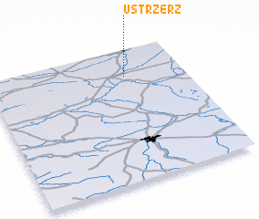 Places with similar names to Ustrzerz, Poland :: Disclaimer :: Information on this page comes without warranty of any kind |
||
|
Where is Ustrzerz? Elevation and coordinates ::
Latitude (lat): 51°48'0"N Longitude (lon): 22°42'0"E
Elevation (approx.): 140m (map arrows pan, magnifying glasses zoom) |
||
|
Visiting Ustrzerz? Hotel/Accommodation ::
Book a hotel in Ustrzerz Travel Guide ::
Buy a travel guide for Poland rental cars ::
car rental offers GPS waypoint ::
download a GPX waypoint (PoI) of Ustrzerz for your GPS receiver
|
||