|
search place name
|
||
Wojska (Poland)Wojska is a town in Poland. An overview map of the region around Wojska is displayed below.
regional and 3d topo map of Wojska, Poland ::

Wojska airports ::
The nearest airport is WAW - Warsaw Okecie, located 66.4 km north east of Wojska.
Other airports nearby include KTW - Katowice Pyrzowice (168.1 km south west), KRK - Krakow Balice (195.5 km south), RZE - Rzeszow Jasionka (229.5 km south east), Nearby towns ::
Janolin (1.1km east) //
Skoczykłody (1.9km south) //
Kolonia Wojska (2.2km north west) //
Stara Rosocha (2.2km north east) //
Wilkowice (2.3km west) //
Zglinna Duża (3.7km north) //
Linków (2.3km east) //
Radoryż Kościelny (2.9km south west) //
Nowa Rosocha (2.9km north east) //
Ścieki (4.4km south east) //
Soszyce (5.6km south) //
Radoryż Smolany (3.9km south west) //
Wysokienice (3.9km south west) //
Jasień (3.9km south west) //
Wałowice (3.9km south east) //
Krzyżanów (5.7km north) //
Kazimierzów (5.7km north) //
Zglinna Mała (5.7km north) //
Złota (6.0km south) //
Żelazna (6.0km north) //
Pasieka Wałowska (5.1km south east) //
Niwna (4.6km east) //
Rzędków (7.5km north) //
Zawady (7.5km south) //
Rogowiec (4.9km east) //
Boguszyce (7.5km south) //
Garłów (7.5km south) //
Dukaczew (6.5km north east) //
Józefatów (7.8km north) //
[all distances 'as the bird flies' and approximate] 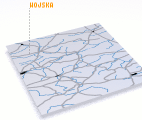
Disclaimer :: Information on this page comes without warranty of any kind |
||
|
Where is Wojska? Elevation and coordinates ::
Latitude (lat): 51°49'0"N Longitude (lon): 20°11'0"E
Elevation (approx.): 178m (map arrows pan, magnifying glasses zoom) |
||
|
Visiting Wojska? Hotel/Accommodation ::
Book a hotel in Wojska Travel Guide ::
Buy a travel guide for Poland rental cars ::
car rental offers GPS waypoint ::
download a GPX waypoint (PoI) of Wojska for your GPS receiver
|
||