|
search place name
|
||
Wróblowa (Poland)Wróblowa is a town in Poland. An overview map of the region around Wróblowa is displayed below.
regional and 3d topo map of Wróblowa, Poland ::

Wróblowa airports ::
The nearest airport is RZE - Rzeszow Jasionka, located 57.2 km north east of Wróblowa.
Other airports nearby include TAT - Poprad Tatry (115.7 km south west), KRK - Krakow Balice (118.8 km west), KSC - Kosice (126.9 km south), Nearby towns ::
Lipnica Górna (1.2km west) //
Bączal Górny (2.2km south west) //
Brzyska (3.7km north) //
Wola Jasienicka (3.9km south) //
Opacie (3.9km south) //
Bączal Dolny (3.0km south west) //
Dąbrówka (3.0km south east) //
Ujazd (3.0km north east) //
Kłodawa (3.0km north east) //
Krajowice (4.4km south east) //
Bukowa (4.4km north east) //
Jabłonica (3.6km west) //
Lipnica Dolna (5.6km north) //
Błaszkowa (5.6km north) //
Sławęcin (5.7km south) //
Trzcinica (5.7km south) //
Lisów (4.0km south west) //
Kołaczyce (4.0km north east) //
Skołyszyn (6.1km south west) //
Bryły (5.2km south east) //
Dębowa (6.6km north west) //
Jareniówka (6.1km south east) //
Grudna Kępska (7.3km south west) //
Jereniówka (7.3km south east) //
Kunowa (8.2km south west) //
Klecie (8.2km north east) //
Głęboka (8.8km south west) //
[all distances 'as the bird flies' and approximate] 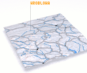 Places with similar names to Wróblowa, Poland ::
Disclaimer :: Information on this page comes without warranty of any kind |
||
|
Where is Wróblowa? Elevation and coordinates ::
Latitude (lat): 49°48'0"N Longitude (lon): 21°23'0"E
Elevation (approx.): 333m (map arrows pan, magnifying glasses zoom) |
||
|
Visiting Wróblowa? Hotel/Accommodation ::
Book a hotel in Wróblowa Travel Guide ::
Buy a travel guide for Poland rental cars ::
car rental offers GPS waypoint ::
download a GPX waypoint (PoI) of Wróblowa for your GPS receiver
|
||