|
search place name
|
||
Żeliszew (Poland)Żeliszew is a town in Poland. An overview map of the region around Żeliszew is displayed below.
regional and 3d topo map of Żeliszew, Poland ::

Żeliszew airports ::
The nearest airport is WAW - Warsaw Okecie, located 69.7 km west of Żeliszew.
Nearby towns ::
Rososz (2.2km north east) //
Koszewnica (3.7km north) //
Łęki (2.9km south west) //
Łączka (2.9km north west) //
Sosnowe (2.9km north west) //
Dobrzanów (4.3km south east) //
Topór (3.4km west) //
Ozorów (3.9km south east) //
Kłódzie (5.0km south east) //
Oleksin (6.0km north) //
Czajków (6.0km south) //
Wilczonek (6.0km north) //
Jagodne (7.4km north) //
Kamieniec (7.5km south) //
Kaczory (7.5km south) //
Bojmie (7.5km north) //
Trezemuszka (4.9km east) //
Borki (5.9km south west) //
Żdżar (7.8km north) //
Sionna (7.8km north) //
Dębowce (8.2km south west) //
Brodki (8.2km south west) //
Ryczyca (7.2km north west) //
Józefin (7.2km north east) //
Mingosy (8.2km north east) //
Groszki Nowe (8.7km north west) //
[all distances 'as the bird flies' and approximate] 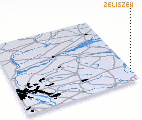 Places with similar names to Żeliszew, Poland ::
Disclaimer :: Information on this page comes without warranty of any kind |
||
|
Where is Żeliszew? Elevation and coordinates ::
Latitude (lat): 52°8'0"N Longitude (lon): 21°59'0"E
Elevation (approx.): 146m (map arrows pan, magnifying glasses zoom) |
||
|
Visiting Żeliszew? Hotel/Accommodation ::
Book a hotel in Żeliszew Travel Guide ::
Buy a travel guide for Poland rental cars ::
car rental offers GPS waypoint ::
download a GPX waypoint (PoI) of Żeliszew for your GPS receiver
|
||