|
search place name
|
||
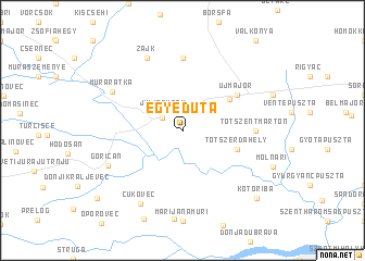
Egyeduta (Zala, Hungary)Egyeduta is a town in the Zala region of Hungary. An overview map of the region around Egyeduta is displayed below.
regional and 3d topo map of Egyeduta, Hungary ::
Egyeduta airports ::
The nearest airport is MBX - Maribor, located 82.0 km west of Egyeduta.
Other airports nearby include ZAG - Zagreb (91.6 km south west), GRZ - Graz (118.8 km north west), VIE - Vienna Schwechat (188.8 km north), BTS - Bratislava M R Stefanik (198.1 km north), Nearby towns ::
Letenye (2.0km north west) //
Béc (2.3km north west) //
Juliánhegy (2.3km north west) //
Annamajor (3.2km north east) //
Becsehely (4.6km north east) //
Tótszerdahely (4.3km south east) //
Újmajor (5.3km north east) //
Kistolmács (7.4km north) //
Tótszentmárton (5.1km east) //
Murarátka (6.4km north west) //
Józsefhegy (7.8km north) //
Zajk (7.8km north) //
Goričan (6.4km south west) //
Čukovec (8.0km south) //
Kotoriba (8.6km south east) //
Hemuševec (9.2km south west) //
[all distances 'as the bird flies' and approximate]  Places with similar names to Egyeduta, Hungary ::
// Egyi Atet (MM)
Disclaimer :: Information on this page comes without warranty of any kind |
||
|
Where is Egyeduta? Elevation and coordinates ::
Latitude (lat): 46°25'0"N Longitude (lon): 16°45'0"E
Elevation (approx.): 142m (map arrows pan, magnifying glasses zoom) |
||
|
Visiting Egyeduta? Hotel/Accommodation ::
Book a hotel in Egyeduta Travel Guide ::
Buy a travel guide for Hungary rental cars ::
car rental offers GPS waypoint ::
download a GPX waypoint (PoI) of Egyeduta for your GPS receiver
|
||