|
search place name
|
||
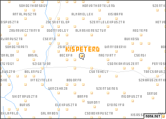
Kispeterd (Baranya, Hungary)Kispeterd is a town in the Baranya region of Hungary. An overview map of the region around Kispeterd is displayed below.
regional and 3d topo map of Kispeterd, Hungary ::
Kispeterd airports ::
The nearest airport is OSI - Osijek, located 98.5 km south east of Kispeterd.
Other airports nearby include ZAG - Zagreb (145.3 km west), BUD - Budapest Ferihegy (184.9 km north east), Nearby towns ::
Domolospuszta (1.3km west) //
Zsibótiszőlőhegy (2.3km north west) //
Zsibót (2.3km north west) //
Botykapeterd (2.3km south west) //
Nagypeterd (2.3km south east) //
Becefa (2.6km west) //
Nyugotszenterzsébet (3.2km north east) //
Turbékpuszta (4.5km north west) //
Csatahely (4.5km south east) //
Rózsafa (5.6km south) //
Nagyváty (3.9km east) //
Bodorfa (5.7km south) //
Hársfapuszta (4.3km north west) //
Almáskeresztúr (5.7km north) //
Péterfa (6.1km south west) //
Szentmiklóspuszta (5.3km north west) //
Mozsgó (6.1km north west) //
Jedinkaszőlő (7.5km north) //
Katádfa (7.5km south) //
Dinnyeberki (5.5km east) //
Ranódfapuszta (7.5km south) //
Ödönyvölgy (6.8km north west) //
Csertő (6.3km north west) //
Kacsóta (6.3km south east) //
Szentlélekpuszta (8.4km north east) //
Zöcsketelep (8.4km north west) //
Szentdénes (8.4km south east) //
Dencsháza (8.4km south west) //
[all distances 'as the bird flies' and approximate]  Places with similar names to Kispeterd, Hungary ::
// Gospiteroda (DE)
Disclaimer :: Information on this page comes without warranty of any kind |
||
|
Where is Kispeterd? Elevation and coordinates ::
Latitude (lat): 46°4'0"N Longitude (lon): 17°53'0"E
Elevation (approx.): 140m (map arrows pan, magnifying glasses zoom) |
||
|
Visiting Kispeterd? Hotel/Accommodation ::
Book a hotel in Kispeterd Travel Guide ::
Buy a travel guide for Hungary rental cars ::
car rental offers GPS waypoint ::
download a GPX waypoint (PoI) of Kispeterd for your GPS receiver
|
||