|
search place name
|
||
Arinsal (Andorra)Arinsal is a town in Andorra. An overview map of the region around Arinsal is displayed below.
regional and 3d topo map of Arinsal, Andorra ::

Arinsal airports ::
The nearest airport is LEU - Seo De Urgel, located 26.1 km south of Arinsal.
Other airports nearby include CCF - Carcassonne Salvaza (98.6 km north east), LRH - La Rochelle Lherm (99.6 km north), PGF - Perpignan Rivesaltes (115.4 km east), TLS - Toulouse Blagnac (118.4 km north), Nearby towns ::
Mas de Ribafeta (0.0km north) //
Puiol del Piu (1.4km east) //
Erts (1.4km east) //
Pal (1.9km south) //
Xixerella (1.9km south) //
La Cortinada (2.7km east) //
Ansalonga (2.7km east) //
Arans (3.3km north east) //
La Massana (3.3km south east) //
El Pui (3.3km south east) //
Escàs (3.3km south east) //
Sispony (4.6km south east) //
Sornàs (4.1km east) //
LʼAldosa (4.5km south east) //
Ordino (4.5km south east) //
Segudet (4.5km south east) //
Llorts (5.5km north east) //
Anyós (5.5km south east) //
Santa Coloma (7.5km south) //
Andorra la Vella (7.9km south) //
Engordany (7.8km south east) //
Les Escaldes (8.5km south east) //
Os de Civís (8.5km south west) //
El Serrat (7.8km north east) //
[all distances 'as the bird flies' and approximate] 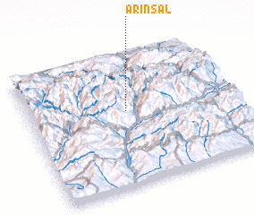
Disclaimer :: Information on this page comes without warranty of any kind |
||
|
Where is Arinsal? Elevation and coordinates ::
Latitude (lat): 42°34'0"N Longitude (lon): 1°29'0"E
Elevation (approx.): 1715m (map arrows pan, magnifying glasses zoom) |
||
|
Visiting Arinsal? Hotel/Accommodation ::
Book a hotel in Arinsal Travel Guide ::
Buy a travel guide for Andorra rental cars ::
car rental offers GPS waypoint ::
download a GPX waypoint (PoI) of Arinsal for your GPS receiver
|
||