|
search place name
|
||
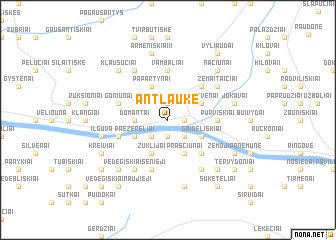
Antlaukė (Lithuania)Antlaukė is a town in Lithuania. An overview map of the region around Antlaukė is displayed below.
regional and 3d topo map of Antlaukė, Lithuania ::
Nearby towns ::
Baraviškiai (1.9km south) //
Motiškiai (1.9km north) //
Seredžius (1.1km east) //
Kriūkai (1.1km east) //
Joginiškiai II (2.1km south west) //
Buožiai (2.1km south east) //
Domantai (2.1km west) //
Joginiškiai I (2.8km south west) //
Paežerėliai (2.8km south west) //
Gaideliškiai (2.8km south east) //
Žuklijai (3.9km south) //
Peštvėnai (2.8km north east) //
Praščiūnai (3.9km south) //
Papartynai (3.9km north) //
Jokūboniai Senieji (4.3km south east) //
Padubysis (4.3km north east) //
Vambaliai (5.6km north) //
Purviškiai (3.2km east) //
Juškai (3.7km south west) //
Puniškiai (5.7km south) //
Goniūnai (3.7km north west) //
Armeniškiai (6.0km north) //
Vedegiškiai Senieji (6.0km south) //
Padainiai (6.0km south) //
Šukėtai (6.0km south) //
Žemaitaičiai (4.9km north east) //
Dauciškiai (7.5km south) //
Ilguva (4.6km south west) //
Armeniškiai II (7.5km north) //
[all distances 'as the bird flies' and approximate]  Places with similar names to Antlaukė, Lithuania ::
Disclaimer :: Information on this page comes without warranty of any kind |
||
|
Where is Antlaukė? Elevation and coordinates ::
Latitude (lat): 55°5'0"N Longitude (lon): 23°24'0"E
Elevation (approx.): 60m (map arrows pan, magnifying glasses zoom) |
||
|
Visiting Antlaukė? Hotel/Accommodation ::
Book a hotel in Antlaukė Travel Guide ::
Buy a travel guide for Lithuania rental cars ::
car rental offers GPS waypoint ::
download a GPX waypoint (PoI) of Antlaukė for your GPS receiver
|
||