|
search place name
|
||
Eželiškės (Lithuania)Eželiškės is a town in Lithuania. An overview map of the region around Eželiškės is displayed below.
regional and 3d topo map of Eželiškės, Lithuania ::

Eželiškės airports ::
The nearest airport is KGD - Kaliningrad Khrabrovo, located 137.3 km south west of Eželiškės.
Nearby towns ::
Lingės (1.9km south) //
Lingių Fermos (2.1km south west) //
Paežeris (1.7km north west) //
Girdiškė (2.5km south east) //
Lingių-Padvarninkai (2.1km east) //
Pazimkalnis (2.8km south west) //
Lingeniškė (3.9km north) //
Jakaičiai (3.9km north) //
Tūjainiai (2.8km north east) //
Pliupiai (4.3km south east) //
Pilsūdai (4.0km south east) //
Upyna (4.5km south west) //
Kumečiai (3.7km south east) //
Klabai (3.7km north east) //
Prienai (3.7km north west) //
Krūtilės (5.7km north) //
Margynė (5.9km south) //
Gaudvaišai (4.9km north east) //
Iždonai (4.9km north west) //
Arvydiškė (7.4km north) //
Kliūkiai (4.6km south west) //
Bruškiai (4.6km north west) //
Padvariai (4.6km south east) //
Mankiškė (4.6km north east) //
Užkalniai (6.4km south east) //
Pagrybis (6.4km north west) //
Kaušai (5.6km north west) //
Paegluonis (8.1km south east) //
Sodalė (8.1km south west) //
[all distances 'as the bird flies' and approximate] 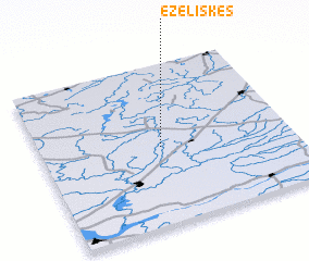 Places with similar names to Eželiškės, Lithuania ::
// Essey-les-Eaux (FR)
Disclaimer :: Information on this page comes without warranty of any kind |
||
|
Where is Eželiškės? Elevation and coordinates ::
Latitude (lat): 55°29'0"N Longitude (lon): 22°29'0"E
Elevation (approx.): 147m (map arrows pan, magnifying glasses zoom) |
||
|
Visiting Eželiškės? Hotel/Accommodation ::
Book a hotel in Eželiškės Travel Guide ::
Buy a travel guide for Lithuania rental cars ::
car rental offers GPS waypoint ::
download a GPX waypoint (PoI) of Eželiškės for your GPS receiver
|
||