|
search place name
|
||
Gėluva (Lithuania)Gėluva is a town in Lithuania. An overview map of the region around Gėluva is displayed below.
regional and 3d topo map of Gėluva, Lithuania ::

Nearby towns ::
Algimantai (1.4km north) //
Žąsinai (1.6km north east) //
Čiužiūnai (2.5km south west) //
Rajinciškiai (3.4km north) //
Antvėjai (3.6km south) //
Negirva (3.2km north east) //
Lenčiai (4.4km north) //
Butkiškė (4.1km south) //
Kunigiškiai (4.1km south) //
Ariogala (3.0km north west) //
Padargupiai (3.2km east) //
Noliečiai (4.3km north west) //
Plikiai (5.3km south) //
Grajauskai (5.6km north) //
Kregždyne (5.9km south) //
Ramučiai (6.3km north) //
Vosbutai (6.2km south west) //
Pigainiai (7.3km north) //
Molupiai (5.7km south east) //
Kasiulkai (7.4km north) //
Stenioniai (4.6km west) //
Šlapučiai (7.2km south east) //
Būdai (7.4km north) //
Pašilaupiai (6.2km north east) //
(( Duogiai )) (4.9km east) //
Šliužiai (5.7km north east) //
Gožiai (5.1km east) //
Paupstaliai (7.3km south west) //
(( Ažuolytė )) (7.5km south east) //
[all distances 'as the bird flies' and approximate] 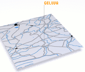 Places with similar names to Gėluva, Lithuania ::
Disclaimer :: Information on this page comes without warranty of any kind |
||
|
Where is Gėluva? Elevation and coordinates ::
Latitude (lat): 55°15'5"N Longitude (lon): 23°30'22"E
Elevation (approx.): 83m (map arrows pan, magnifying glasses zoom) |
||
|
Visiting Gėluva? Hotel/Accommodation ::
Book a hotel in Gėluva Travel Guide ::
Buy a travel guide for Lithuania rental cars ::
car rental offers GPS waypoint ::
download a GPX waypoint (PoI) of Gėluva for your GPS receiver
|
||