|
search place name
|
||
Pakruojis (Lithuania)Pakruojis is a town in Lithuania. An overview map of the region around Pakruojis is displayed below.
regional and 3d topo map of Pakruojis, Lithuania ::
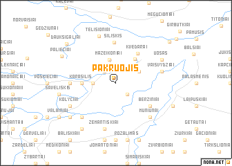
Nearby towns ::
Bešoniai (2.1km south east) //
Pašilis (2.1km north west) //
Pašiliai (2.1km north west) //
Jovarai (2.1km west) //
Mažeikoniai (3.8km north) //
Nereikoniai (2.8km north east) //
Noreikoniai (4.2km north east) //
Karašilis (3.1km west) //
Kvedarai (5.1km north east) //
Šiliškis (6.5km north) //
Beržiniai (4.8km south east) //
Linksmučiai (4.1km west) //
Vaišvydžiai (4.5km north east) //
Karklinė (4.5km north east) //
Akmenynė (7.5km south) //
Žemantiškiai (7.5km south) //
Juškoniai (6.4km south west) //
Muniūnai (6.4km south east) //
Telišioniai (7.7km north) //
Uošas (5.6km north east) //
Kolyčiai (5.6km south west) //
Preičiūnai (6.9km south west) //
Bališkiai II (8.0km south west) //
Paliečiai (6.5km north west) //
Daukšigaliai (7.7km north west) //
Petrašiūnai (8.2km north east) //
[all distances 'as the bird flies' and approximate] 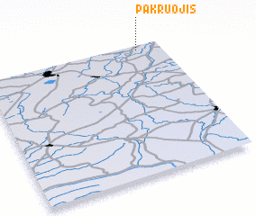
Disclaimer :: Information on this page comes without warranty of any kind |
||
|
Where is Pakruojis? Elevation and coordinates ::
Latitude (lat): 55°58'0"N Longitude (lon): 23°52'0"E
Elevation (approx.): 61m (map arrows pan, magnifying glasses zoom) |
||
|
Visiting Pakruojis? Hotel/Accommodation ::
Book a hotel in Pakruojis Travel Guide ::
Buy a travel guide for Lithuania rental cars ::
car rental offers GPS waypoint ::
download a GPX waypoint (PoI) of Pakruojis for your GPS receiver
|
||