|
search place name
|
||
Priekulė (Lithuania)Priekulė is a town in Lithuania. An overview map of the region around Priekulė is displayed below.
regional and 3d topo map of Priekulė, Lithuania ::

Priekulė airports ::
The nearest airport is KGD - Kaliningrad Khrabrovo, located 87.4 km south west of Priekulė.
Nearby towns ::
Voveriškiai (1.6km north west) //
Šventvakariai (2.3km south) //
Gropiškiai (2.3km south) //
Stragnai (1.5km east) //
Drukiai (1.7km west) //
Kuodžiai (2.2km north west) //
Butkai (3.4km north) //
Pleškučiai (2.8km south west) //
Biržininkai (4.1km south) //
Mėželiai (4.2km south) //
Venckai (4.2km south) //
Grėžiai (2.9km north east) //
Būdviečiai (2.9km north east) //
Jokšai (4.4km south) //
Rokai (5.2km north) //
Juodikiai (5.4km north) //
Dituva (5.4km north) //
Grumbliai (6.1km south) //
Dreižiai (4.2km south east) //
Kalviškiai (6.8km south) //
Piauliai (4.4km south west) //
Egluonėnai (4.9km north east) //
Kantvonai (4.9km north east) //
Vilkyčiai (5.4km south east) //
Šilininkai (4.6km east) //
Mickai (6.4km north west) //
Lankupiai (7.9km south) //
Dreverna (5.3km south west) //
Lamsočiai (8.6km south) //
[all distances 'as the bird flies' and approximate] 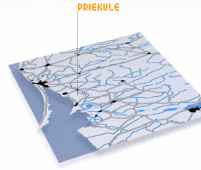 Places with similar names to Priekulė, Lithuania ::
Disclaimer :: Information on this page comes without warranty of any kind |
||
|
Where is Priekulė? Elevation and coordinates ::
Latitude (lat): 55°33'13"N Longitude (lon): 21°19'36"E
Elevation (approx.): 2m (map arrows pan, magnifying glasses zoom) |
||
|
Visiting Priekulė? Hotel/Accommodation ::
Book a hotel in Priekulė Travel Guide ::
Buy a travel guide for Lithuania rental cars ::
car rental offers GPS waypoint ::
download a GPX waypoint (PoI) of Priekulė for your GPS receiver
|
||