|
search place name
|
||
Ratkūnai (Panevėžio Apskritis, Lithuania)Ratkūnai is a town in the Panevėžio Apskritis region of Lithuania. An overview map of the region around Ratkūnai is displayed below.
regional and 3d topo map of Ratkūnai, Lithuania ::

Nearby towns ::
Kyburiai (2.7km south) //
Birzgaļi (3.1km north) //
Puodžiūnai (2.4km south west) //
Krievgaļi (2.8km north west) //
Eidžiotoniai (4.8km south) //
Brunavišķi (3.8km north west) //
Gineikiai (5.4km south) //
(( Brūklāji )) (5.0km north east) //
Pamučiai (4.1km south west) //
Kervesiai (4.8km south west) //
Kiemėnai (4.2km east) //
Kaupai (7.5km south) //
Švokštoniai (6.1km south west) //
Pāce (7.1km north) //
Daičiūnai (8.2km south) //
Velžiai (6.8km south east) //
Kamardai (5.8km north east) //
Nairiai (7.0km south west) //
Namajūnai (5.5km north east) //
Namišiai (7.0km south east) //
Nakvosai (8.7km south west) //
[all distances 'as the bird flies' and approximate] 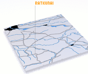 Places with similar names to Ratkūnai, Lithuania ::
Disclaimer :: Information on this page comes without warranty of any kind |
||
|
Where is Ratkūnai? Elevation and coordinates ::
Latitude (lat): 56°15'36"N Longitude (lon): 24°13'45"E
Elevation (approx.): 36m (map arrows pan, magnifying glasses zoom) |
||
|
Visiting Ratkūnai? Hotel/Accommodation ::
Book a hotel in Ratkūnai Travel Guide ::
Buy a travel guide for Lithuania rental cars ::
car rental offers GPS waypoint ::
download a GPX waypoint (PoI) of Ratkūnai for your GPS receiver
|
||