|
search place name
|
||
Vytūliai (Lithuania)Vytūliai is a town in Lithuania. An overview map of the region around Vytūliai is displayed below.
regional and 3d topo map of Vytūliai, Lithuania ::

Vytūliai airports ::
The nearest airport is KGD - Kaliningrad Khrabrovo, located 80.1 km south west of Vytūliai.
Nearby towns ::
Petreliai (1.7km north) //
Žemaitkiemiai (1.3km east) //
Lapalės (3.4km south) //
Alka (2.2km west) //
Medalės (2.4km north east) //
Saugos (4.8km north) //
Kukorai (5.2km north) //
Mantvydai (5.7km north) //
Traksėdžiai (6.3km south) //
Išlūžė (5.6km north west) //
Laugaliai (6.7km north) //
Grabupai (5.7km south east) //
Vilkmedžiai (7.4km north) //
Kalnininkai (5.6km south east) //
Čiūtalės (8.6km north) //
Gincai (5.1km east) //
Sakuotėliai (8.7km north) //
Barzdūnai (8.0km south) //
Šyšgiriai (8.5km south) //
Beržiškiai (5.8km north east) //
Begėdžiai (8.9km north) //
Šilutė (8.5km south) //
Bundalai (7.0km north west) //
Grabupiai (7.5km south east) //
Grynaičiai (9.5km north east) //
Lankupiai (8.7km north west) //
[all distances 'as the bird flies' and approximate] 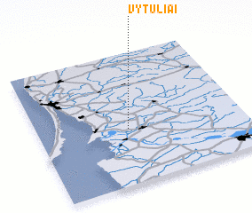 Places with similar names to Vytūliai, Lithuania ::
Disclaimer :: Information on this page comes without warranty of any kind |
||
|
Where is Vytūliai? Elevation and coordinates ::
Latitude (lat): 55°25'17"N Longitude (lon): 21°26'21"E
Elevation (approx.): 2m (map arrows pan, magnifying glasses zoom) |
||
|
Visiting Vytūliai? Hotel/Accommodation ::
Book a hotel in Vytūliai Travel Guide ::
Buy a travel guide for Lithuania rental cars ::
car rental offers GPS waypoint ::
download a GPX waypoint (PoI) of Vytūliai for your GPS receiver
|
||