|
search place name
|
||
Velna (Põlvamaa, Estonia)Velna is a town in the Põlvamaa region of Estonia. An overview map of the region around Velna is displayed below.
regional and 3d topo map of Velna, Estonia ::
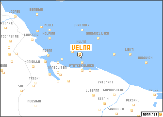
Nearby towns ::
Saarekula (0.9km south) //
Podmotsa (1.9km north west) //
Kul'ye (2.8km north) //
Vyayke Kuliska (2.8km south) //
Sur Kuliska (3.0km south) //
Kremessova (2.4km west) //
Väike-Rõsna (3.0km west) //
Sur-Drizliviku (5.1km north east) //
Verhulitsa (5.5km south) //
Värska (4.6km south west) //
Määsovitsa (4.3km south west) //
Shartova (6.5km north) //
Õrsava (5.9km south west) //
Krasnaya Gora (4.1km east) //
Rõsna (4.1km west) //
Slobotka (5.3km south west) //
Tonja (4.4km west) //
Yatsmani (7.2km south east) //
Kolpina (6.0km north west) //
Lutepää (8.6km south) //
Medli (7.5km north west) //
Gorodishche (9.2km south east) //
[all distances 'as the bird flies' and approximate] 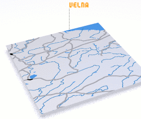 Places with similar names to Velna, Estonia ::
Disclaimer :: Information on this page comes without warranty of any kind |
||
|
Where is Velna? Elevation and coordinates ::
Latitude (lat): 57°59'30"N Longitude (lon): 27°40'56"E
Elevation (approx.): 35m (map arrows pan, magnifying glasses zoom) |
||
|
Visiting Velna? Hotel/Accommodation ::
Book a hotel in Velna Travel Guide ::
Buy a travel guide for Estonia rental cars ::
car rental offers GPS waypoint ::
download a GPX waypoint (PoI) of Velna for your GPS receiver
|
||