|
search place name
|
||
Canalito (Holguín, Cuba)Canalito is a town in the Holguín region of Cuba. An overview map of the region around Canalito is displayed below.
regional and 3d topo map of Canalito, Cuba ::

Canalito airports ::
The nearest airport is HOG - Holguin Frank Pais Intl, located 67.3 km west of Canalito.
Other airports nearby include MOA - Moa Orestes Acosta (80.7 km east), SCU - Santiago De Cuba Antonio Maceo Intl (98.0 km south), GAO - Guantanamo Mariana Grajales (99.3 km south east), BYM - Bayamo Carlos Manuel De Cespedes (110.6 km south west), Nearby towns ::
El Júcaro (4.4km north west) //
Antilla (6.9km west) //
La Chiva (8.2km east) //
Embarcadero de Banes (8.9km north) //
Macabí (9.2km north west) //
[all distances 'as the bird flies' and approximate] 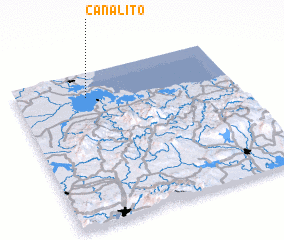 Places with similar names to Canalito, Cuba ::
// Canluto (PH)
// Kanalate (PH)
// Cana Alta (CU)
// Canalete (CU)
// Guano Alto (CU)
// Günaltı (TR)
// Kinlet (GB)
// Quiuña Alto (CL)
// Canalete (CO)
// Canalete (CO)
Disclaimer :: Information on this page comes without warranty of any kind |
||
|
Where is Canalito? Elevation and coordinates ::
Latitude (lat): 20°50'28"N Longitude (lon): 75°40'16"W
Elevation (approx.): 11m (map arrows pan, magnifying glasses zoom) |
||
|
Visiting Canalito? Hotel/Accommodation ::
Book a hotel in Canalito Travel Guide ::
Buy a travel guide for Cuba rental cars ::
car rental offers GPS waypoint ::
download a GPX waypoint (PoI) of Canalito for your GPS receiver
|
||