|
search place name
|
||
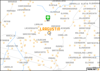
La Agustín (Ciego de Ávila, Cuba)La Agustín is a town in the Ciego de Ávila region of Cuba. An overview map of the region around La Agustín is displayed below.
regional and 3d topo map of La Agustín, Cuba ::
La Agustín airports ::
The nearest airport is AVI - Ciego De Avila Maximo Gomez, located 6.7 km north of La Agustín.
Other airports nearby include CMW - Camaguey Ignacio Agramonte Intl (114.2 km south east), SNU - Santa Clara Abel Santamaria (133.0 km north west), CFG - Cienfuegos Jaime Gonzalez (169.6 km west), VTU - Las Tunas Hermanos Ameijeiras (220.0 km south east), Nearby towns ::
Tres Ceibas (1.3km south east) //
Virginia (1.6km west) //
Candelaria (1.9km north) //
Porvenir (3.3km north east) //
Gangalito (3.4km north west) //
La Mina (3.7km south west) //
La María (3.9km north west) //
La Jocuma (4.0km south west) //
Santa Rita (4.0km south west) //
Vistahermosa (4.0km west) //
Vista Alegre (4.4km north west) //
Ceballos (4.5km east) //
Santa Úrsula (5.1km south west) //
La Palma (5.2km north west) //
La Vigía (5.7km south) //
El Coco (5.3km west) //
El Azufre (5.4km west) //
La Caridad (5.5km east) //
San José (5.8km north) //
Pozo Azul (5.7km west) //
Ruspoli (6.0km south east) //
La Aguadita (6.3km south) //
San Juan (6.3km south west) //
Santo Tomás (7.1km south east) //
El Mamey (7.0km south west) //
La Cieneguita (6.9km west) //
Colmenar (7.5km south) //
El Azufre (7.1km west) //
San Cristóbal (7.1km west) //
[all distances 'as the bird flies' and approximate]  Places with similar names to La Agustín, Cuba ::
// Lugastaun (PH)
// Laxten (DE)
// Loxten (DE)
// Loxten (DE)
// La Agustina (PA)
// La Agustina (PA)
// La Agustina (PA)
// Laukstėnai (LT)
// Lagzdiena (LV)
// Lakstene (LV)
Disclaimer :: Information on this page comes without warranty of any kind |
||
|
Where is La Agustín? Elevation and coordinates ::
Latitude (lat): 21°58'0"N Longitude (lon): 78°47'0"W
Elevation (approx.): 73m (map arrows pan, magnifying glasses zoom) |
||
|
Visiting La Agustín? Hotel/Accommodation ::
Book a hotel in La Agustín Travel Guide ::
Buy a travel guide for Cuba rental cars ::
car rental offers GPS waypoint ::
download a GPX waypoint (PoI) of La Agustín for your GPS receiver
|
||