|
search place name
|
||
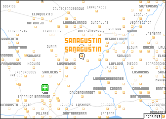
San Agustín (Villa Clara, Cuba)San Agustín is a town in the Villa Clara region of Cuba. An overview map of the region around San Agustín is displayed below.
regional and 3d topo map of San Agustín, Cuba ::
San Agustín airports ::
The nearest airport is SNU - Santa Clara Abel Santamaria, located 10.2 km south west of San Agustín.
Other airports nearby include CFG - Cienfuegos Jaime Gonzalez (71.7 km south west), AVI - Ciego De Avila Maximo Gomez (125.2 km south east), VRA - Varadero Juan Gualberto Gomez Intl (169.8 km west), CYO - Cayo Vilo Acuna Intl (201.8 km south west), Nearby towns ::
Las Mercedes (1.0km east) //
Las Cuevas (1.7km west) //
Primera Concepción (1.7km west) //
San Agustín (1.9km north) //
Segunda Concepción (2.5km north west) //
Paredes (2.5km south west) //
San Miguel y Las Marías (2.5km south west) //
San Rafael (3.6km north east) //
San Francisco (3.4km west) //
La Caridad (3.4km east) //
Canoa (3.8km east) //
El Chivo (3.9km north west) //
Delicias (3.9km south west) //
Las Piedras (3.9km south west) //
San Lázaro (5.0km south west) //
San Salvador (5.0km south west) //
Santa Ana (5.0km north east) //
Vega Alta (4.9km east) //
Las Pozas De Blanquizar (5.1km west) //
Barrenechea (5.6km north) //
Alto Songo (5.4km south west) //
La Levisa (5.5km east) //
El Mango (5.5km east) //
Chicharón (5.5km east) //
Abel Santamaría (5.8km north) //
Cayo Hueso (5.8km north) //
El Mango (5.8km north) //
San Miguel (5.7km south west) //
Paso Real (5.8km north east) //
[all distances 'as the bird flies' and approximate]  Places with similar names to San Agustín, Cuba ::
// San Agustin (US)
// San Augustine (US)
// San Agustín (PA)
// San Agustín (PA)
// San Agustín (CU)
// San Agustín (CU)
// San Agustín (CU)
// San Agustín (CU)
// San Agustín (CU)
// San Agustín (CU)
Disclaimer :: Information on this page comes without warranty of any kind |
||
|
Where is San Agustín? Elevation and coordinates ::
Latitude (lat): 22°33'0"N Longitude (lon): 79°52'0"W
Elevation (approx.): 69m (map arrows pan, magnifying glasses zoom) |
||
|
Visiting San Agustín? Hotel/Accommodation ::
Book a hotel in San Agustín Travel Guide ::
Buy a travel guide for Cuba rental cars ::
car rental offers GPS waypoint ::
download a GPX waypoint (PoI) of San Agustín for your GPS receiver
|
||