|
search place name
|
||
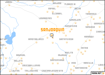
San Joaquín (Ciego de Ávila, Cuba)San Joaquín is a town in the Ciego de Ávila region of Cuba. An overview map of the region around San Joaquín is displayed below.
regional and 3d topo map of San Joaquín, Cuba ::
San Joaquín airports ::
The nearest airport is AVI - Ciego De Avila Maximo Gomez, located 25.3 km east of San Joaquín.
Other airports nearby include SNU - Santa Clara Abel Santamaria (105.8 km north west), CMW - Camaguey Ignacio Agramonte Intl (141.1 km south east), CFG - Cienfuegos Jaime Gonzalez (142.9 km west), MZO - Manzanillo Sierra Maestra (280.7 km south east), Nearby towns ::
San Jerónimo (0.0km north) //
San Galillo (1.7km west) //
Alto Cedro (1.9km south) //
San Felipe (2.9km north east) //
Plátano Negro (3.9km north east) //
Sitio Nuevo (4.1km north east) //
San Francisco de la Rosa (4.5km east) //
Santa Teresa (5.0km east) //
Arroyo Blanco (5.6km west) //
Los Ramones (6.2km north) //
La Esperanza (6.1km east) //
Purgatorio (6.9km north east) //
Los Cristales (7.4km south) //
El Coabal (7.6km north) //
Majagua (8.2km south east) //
Adelita (8.6km south east) //
Guadalupe (9.2km north east) //
El Baño (11.2km north east) //
[all distances 'as the bird flies' and approximate]  Places with similar names to San Joaquín, Cuba ::
// San Joaquin (BZ)
// San Joaquin (US)
// San Joaquín (PA)
// San Joaquín (CU)
// San Joaquín (CU)
// San Joaquín (CU)
// San Joaquín (CU)
// San Joaquín (CU)
// San Joaquín (CU)
// San Joaquín (CU)
Disclaimer :: Information on this page comes without warranty of any kind |
||
|
Where is San Joaquín? Elevation and coordinates ::
Latitude (lat): 22°3'0"N Longitude (lon): 79°2'0"W
Elevation (approx.): 244m (map arrows pan, magnifying glasses zoom) |
||
|
Visiting San Joaquín? Hotel/Accommodation ::
Book a hotel in San Joaquín Travel Guide ::
Buy a travel guide for Cuba rental cars ::
car rental offers GPS waypoint ::
download a GPX waypoint (PoI) of San Joaquín for your GPS receiver
|
||