|
search place name
|
||
Santa Elena (Granma, Cuba)Santa Elena is a town in the Granma region of Cuba. An overview map of the region around Santa Elena is displayed below.
regional and 3d topo map of Santa Elena, Cuba ::

Santa Elena airports ::
The nearest airport is MZO - Manzanillo Sierra Maestra, located 3.3 km south of Santa Elena.
Other airports nearby include BYM - Bayamo Carlos Manuel De Cespedes (50.7 km east), VTU - Las Tunas Hermanos Ameijeiras (76.2 km north), HOG - Holguin Frank Pais Intl (96.9 km north east), SCU - Santiago De Cuba Antonio Maceo Intl (137.7 km east), Nearby towns ::
Caña (1.7km east) //
San Joaquín (1.7km west) //
La Vuelta del Caño (2.5km north east) //
Salado (2.5km north east) //
Santa Isabel (2.5km north west) //
Caridad (2.5km south east) //
Cuentas Claras (2.5km south east) //
Manzanillo (3.4km north west) //
Monte Alto (3.5km east) //
Ciudad Pesquera (3.7km north) //
Gertrudis (3.5km west) //
Villa Blanca (3.5km west) //
Las Novillas (3.9km north east) //
Palmas Altas (3.9km south east) //
Tejar (4.1km north east) //
Blanquizal (4.1km north east) //
Rosabal (3.9km south west) //
Congo (5.1km south west) //
Palmas Altas (5.2km east) //
Jibacoa (5.5km west) //
El Alto (5.8km north) //
San José (5.5km west) //
Rancho (5.5km west) //
Las Obas (6.6km north east) //
San Fernando (6.4km north east) //
Ubero (6.4km north east) //
Etibucabo (6.4km north east) //
Cuatro Caminos (6.6km south west) //
La Demajagua (7.2km west) //
[all distances 'as the bird flies' and approximate] 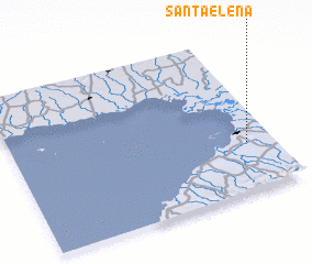 Places with similar names to Santa Elena, Cuba ::
// Sondalin (MM)
// Santa Elena (BZ)
// Saint Leon (US)
// Santa Elena (PA)
// Santa Elena (PA)
// Sandálion (GR)
// Santa Elena (CU)
// Santa Elena (CU)
// Santa Elena (CU)
// Santa Elena (CU)
Disclaimer :: Information on this page comes without warranty of any kind |
||
|
Where is Santa Elena? Elevation and coordinates ::
Latitude (lat): 20°19'0"N Longitude (lon): 77°6'0"W
Elevation (approx.): 88m (map arrows pan, magnifying glasses zoom) |
||
|
Visiting Santa Elena? Hotel/Accommodation ::
Book a hotel in Santa Elena Travel Guide ::
Buy a travel guide for Cuba rental cars ::
car rental offers GPS waypoint ::
download a GPX waypoint (PoI) of Santa Elena for your GPS receiver
|
||