|
search place name
|
||
Santa Rosa (Villa Clara, Cuba)Santa Rosa is a town in the Villa Clara region of Cuba. An overview map of the region around Santa Rosa is displayed below.
regional and 3d topo map of Santa Rosa, Cuba ::

Santa Rosa airports ::
The nearest airport is CFG - Cienfuegos Jaime Gonzalez, located 72.7 km south east of Santa Rosa.
Other airports nearby include VRA - Varadero Juan Gualberto Gomez Intl (81.8 km north west), SNU - Santa Clara Abel Santamaria (82.8 km east), CYO - Cayo Vilo Acuna Intl (152.9 km south west), HAV - Havana Jose Marti Intl (177.4 km west), Nearby towns ::
Los Pinos (0.7km south east) //
Macagua Vieja (1.0km south east) //
La Panchita (1.7km east) //
Sitios (1.7km east) //
Zuarnaba (1.7km west) //
San Antonio (1.9km south) //
La Palma (2.2km south) //
Bella Unión (2.5km south east) //
Bacallao (2.5km north west) //
Vidal (2.5km north east) //
La Fruta (2.6km south) //
San José (3.2km south) //
Los Arabos (3.3km south west) //
Santa Inés (3.5km south east) //
Dulce Nombre (3.4km east) //
Santa Palomina (3.7km south east) //
Sin Nombre de Cerice (3.9km north west) //
San Julián (3.9km north west) //
Guerrero (3.9km north west) //
Santa Beatriz (3.9km north west) //
Brufaou (3.9km north east) //
Guachinango (3.9km north east) //
Santa Isabel (3.9km south east) //
Cuatro Esquinas (4.3km south east) //
Occitania (4.7km south west) //
Encarnación (4.7km south east) //
Santa Ana (4.9km south) //
San Severino (4.7km south east) //
Sobrado (5.2km south east) //
[all distances 'as the bird flies' and approximate] 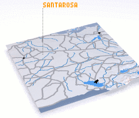 Places with similar names to Santa Rosa, Cuba ::
// Sania Torres (MA)
// Santa Rosa (BR)
// Santa Rosa (BR)
// Santa Rosa (BR)
// Santa Rosa (BR)
// Santa Rosa (BR)
// Santa Rosa (BR)
// Santa Rosa (BR)
// Santa Rosa (BR)
// Santa Rosa (BR)
Disclaimer :: Information on this page comes without warranty of any kind |
||
|
Where is Santa Rosa? Elevation and coordinates ::
Latitude (lat): 22°45'0"N Longitude (lon): 80°42'0"W
Elevation (approx.): 60m (map arrows pan, magnifying glasses zoom) |
||
|
Visiting Santa Rosa? Hotel/Accommodation ::
Book a hotel in Santa Rosa Travel Guide ::
Buy a travel guide for Cuba rental cars ::
car rental offers GPS waypoint ::
download a GPX waypoint (PoI) of Santa Rosa for your GPS receiver
|
||