|
search place name
|
||
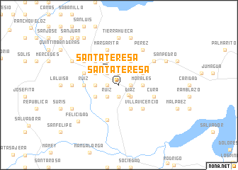
Santa Teresa (Villa Clara, Cuba)Santa Teresa is a town in the Villa Clara region of Cuba. An overview map of the region around Santa Teresa is displayed below.
regional and 3d topo map of Santa Teresa, Cuba ::
Santa Teresa airports ::
The nearest airport is SNU - Santa Clara Abel Santamaria, located 47.6 km south east of Santa Teresa.
Other airports nearby include CFG - Cienfuegos Jaime Gonzalez (73.6 km south), VRA - Varadero Juan Gualberto Gomez Intl (122.7 km west), AVI - Ciego De Avila Maximo Gomez (174.5 km south east), CYO - Cayo Vilo Acuna Intl (185.9 km south west), Nearby towns ::
Pineda (1.7km west) //
San José (1.7km west) //
Morales (1.7km west) //
San Miguel (1.7km west) //
Pérez (1.7km west) //
Arístides (1.7km west) //
Ruiz (1.9km north) //
Reyes (1.9km north) //
La Cañada Placeres (1.9km north) //
Morales (1.7km east) //
Jicotea (1.9km south) //
Quemado de Güines (2.1km south east) //
Cesareo Ruiz (2.5km north west) //
Los Mudos (2.5km north west) //
Santa Teresa (2.5km north west) //
Sucesión de Ruiz (2.5km south west) //
Marlote y Quintana (2.5km south west) //
Dolores (2.5km south west) //
Ruiz (2.5km south west) //
Panchito Gómez Toro (2.5km south west) //
Díaz (2.5km south east) //
Sánchez (3.4km west) //
Morales (3.4km east) //
El Cupey (4.1km north west) //
Santa Ana (3.9km north west) //
Resolución (3.9km north west) //
La Chuchita (3.9km north west) //
Longa (3.9km south west) //
Pérez (3.9km south west) //
[all distances 'as the bird flies' and approximate] 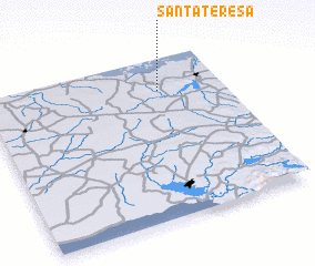 Places with similar names to Santa Teresa, Cuba ::
// Santa Teresa (BR)
// Santa Teresa (BR)
// Santa Teresa (BR)
// Santa Teresa (BR)
// Santa Teresa (BR)
// Santa Teresa (BR)
// Santa Teresa (BR)
// Santa Teresa (BR)
// Santa Teresa (BR)
// Santa Teresa (BR)
Disclaimer :: Information on this page comes without warranty of any kind |
||
|
Where is Santa Teresa? Elevation and coordinates ::
Latitude (lat): 22°48'0"N Longitude (lon): 80°16'0"W
Elevation (approx.): 93m (map arrows pan, magnifying glasses zoom) |
||
|
Visiting Santa Teresa? Hotel/Accommodation ::
Book a hotel in Santa Teresa Travel Guide ::
Buy a travel guide for Cuba rental cars ::
car rental offers GPS waypoint ::
download a GPX waypoint (PoI) of Santa Teresa for your GPS receiver
|
||