|
search place name
|
||
Bajramaj (Lezhë, Albania)Bajramaj is a town in the Lezhë region of Albania. An overview map of the region around Bajramaj is displayed below.
regional and 3d topo map of Bajramaj, Albania ::

Bajramaj airports ::
The nearest airport is TGD - Podgorica, located 55.6 km north of Bajramaj.
Other airports nearby include TIA - Tirana Rinas (56.3 km south), TIV - Tivat (85.0 km north west), DBV - Dubrovnik (125.1 km north west), OHD - Ohrid (131.3 km south east), Nearby towns ::
Baks-Rrjoll (3.2km south) //
Mali Kolaj (2.9km north west) //
Bend (4.5km north) //
Jugë (4.9km north) //
Mali i Jushit (4.3km north east) //
Fshati i Ri (5.0km north) //
Lagjja e Re (4.6km north west) //
Malecaj (4.5km east) //
Sums (5.8km north) //
Torovicë (4.8km east) //
Trushi i Poshtëm (7.4km north) //
Baks i Ri (6.3km north west) //
(( Barbullush i Sipërm )) (6.3km north east) //
Ranxë (7.7km north) //
(( Barbullush i Poshtëm )) (6.4km north east) //
Barbullush (6.9km north east) //
Gomsiqja e Re (6.6km west) //
Kukël (6.6km east) //
Velipojë (6.6km west) //
Mali i Rencit (7.2km south east) //
Bushat (8.9km north east) //
Shkjezë (8.7km north east) //
[all distances 'as the bird flies' and approximate] 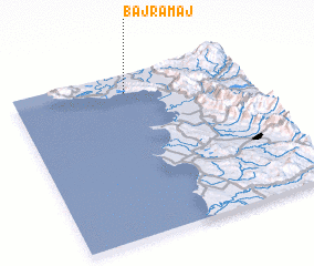 Places with similar names to Bajramaj, Albania :: Disclaimer :: Information on this page comes without warranty of any kind |
||
|
Where is Bajramaj? Elevation and coordinates ::
Latitude (lat): 41°53'21"N Longitude (lon): 19°29'1"E
Elevation (approx.): 105m (map arrows pan, magnifying glasses zoom) |
||
|
Visiting Bajramaj? Hotel/Accommodation ::
Book a hotel in Bajramaj Travel Guide ::
Buy a travel guide for Albania rental cars ::
car rental offers GPS waypoint ::
download a GPX waypoint (PoI) of Bajramaj for your GPS receiver
|
||