|
search place name
|
||
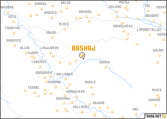
Bashaj (Vlorë, Albania)Bashaj is a town in the Vlorë region of Albania. An overview map of the region around Bashaj is displayed below.
regional and 3d topo map of Bashaj, Albania ::
Bashaj airports ::
The nearest airport is CFU - Kerkyra/corfu Ioannis Kapodistrias Intl, located 80.2 km south of Bashaj.
Other airports nearby include IOA - Ioannina (114.7 km south east), TIA - Tirana Rinas (122.4 km north), OHD - Ohrid (128.0 km north east), KSO - Kastoria Aristotelis (131.4 km east), Nearby towns ::
Matogjin (1.3km west) //
Verbas (2.5km west) //
Vërmik (4.2km south east) //
Ramicë (4.1km west) //
Ballaban (5.4km south west) //
Mogilë (6.3km south) //
Shalës (6.2km south west) //
Velçë (5.3km west) //
Mesaplik (6.9km south west) //
Lagjja e Re (5.9km west) //
Bolenë (7.9km south) //
Ploçë (7.6km north west) //
Fushë (6.8km south west) //
Hundëxhep (8.5km south) //
Vajzë (7.4km north west) //
Mazhar-Sevaster (8.7km north) //
Sinovak (7.8km south west) //
Hor (8.7km south) //
Kangarem (7.8km south west) //
Brataj (8.1km south west) //
Bramush (9.4km south west) //
Likudhe (9.6km south west) //
Grykë (10.1km south west) //
Dorëz (10.5km north east) //
[all distances 'as the bird flies' and approximate]  Places with similar names to Bashaj, Albania ::
Disclaimer :: Information on this page comes without warranty of any kind |
||
|
Where is Bashaj? Elevation and coordinates ::
Latitude (lat): 40°18'46"N Longitude (lon): 19°44'40"E
Elevation (approx.): 514m (map arrows pan, magnifying glasses zoom) |
||
|
Visiting Bashaj? Hotel/Accommodation ::
Book a hotel in Bashaj Travel Guide ::
Buy a travel guide for Albania rental cars ::
car rental offers GPS waypoint ::
download a GPX waypoint (PoI) of Bashaj for your GPS receiver
|
||